
Housatonic NRD photos
Housatonic River Basin Natural Resource Restoration Plan
Project Photos
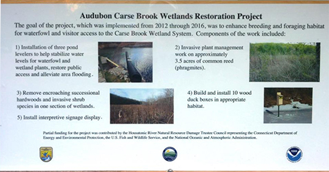
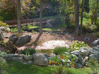
Audubon Carse Brook Wetlands Restoration
Photos Courtesy of Mike Dudek
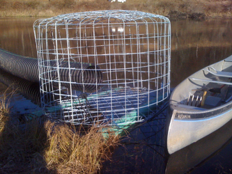
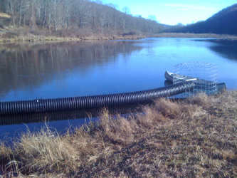
Water leveler at Carse Brook
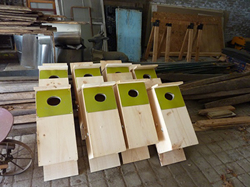
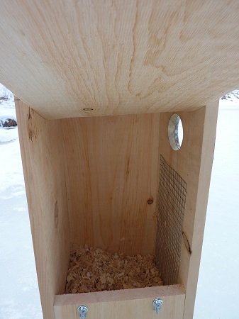
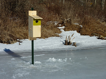
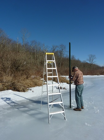
Wood duck boxes and installation.
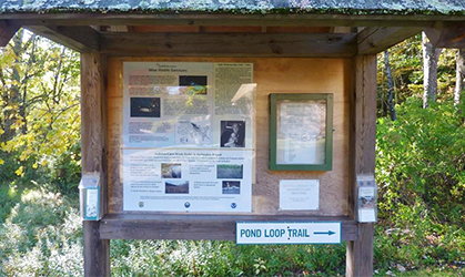
Kiosk at Carse Brook restoration site.
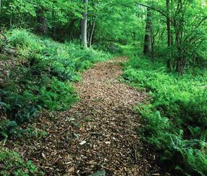
Ball Pond and Shortwoods Brooks Water Quality Improvement and Pedestrian Access
Photos courtesy of Patty Mota, Town of New Fairfield
The bridge at Ball Pond.
The trail at Ball Pond.
Native grasses at Ball Pond.
Beacon Falls Riverfront Park System
Photos courtesy of Michael H. Horbal
Construction of the current break boulders at the canoe/kayak launch site. Route 8 overpass in the background.
![]()
A flock of ducks enjoying the river is a common scene.
![]()
Improvements include expanded walkways for fishing access.
![]()
Improvement to walkway near the launch area.
![]()
Campville Fishing Access, Harwinton
Photos courtesy of U.S. Fish and Wildlife Service (USFWS)
An angler enjoys newly protected fishing access along the Naugatuck River in Harwinton.

Nearly 10 acres of riparian habitat have been conserved in Harwinton to protect the river and provide fishing access.
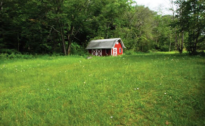
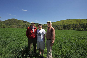
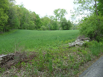
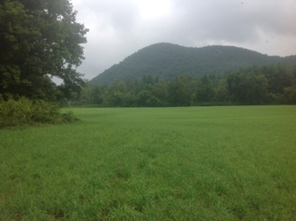
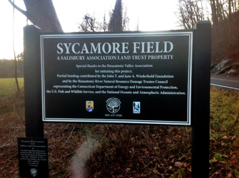
Conservation of the Frost and CL&P Riverfront Properties, Sharon
Photos courtesy of Elaine Hecht, USFWS and Salisbury Association Land Trust
Lou Hecht (left) and George Massey (right), co-chairmen of the Salisbury Association Land Trust and Tim Abbott (center) of the Housatonic Valley Association, at the newly protected 39-acre Belter property in Salisbury, Connecticut.
The Housatonic Valley Association used funds to protect 20 acres of farmland along the Housatonic River in Sharon.
Second growth after first cutting at Sycamore Meadows.
Sign at Sycamore Meadows.
Local high school VO-AG team at work.
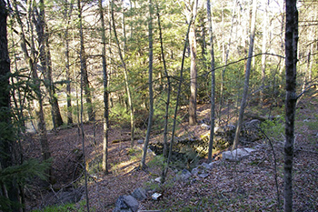
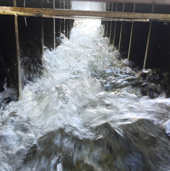
Fish Ladder Repair and Riparian Vegetation Restoration, Cornwall
Photo courtesy of the Housatonic Valley Association
River Logic Solutions, Inc. installed the new fishway at Furnace Brook.
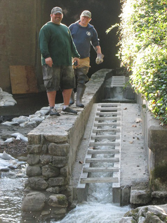
Positioning the three Steeppass units.
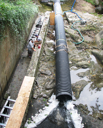
The baffles of the fish ladder allow native brook trout to more easily pass through the culvert and return to primordial spawning grounds.
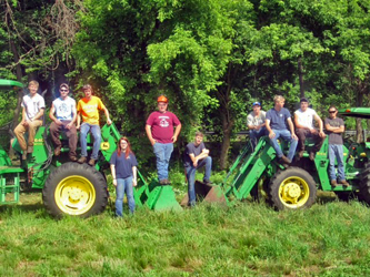
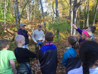
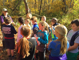
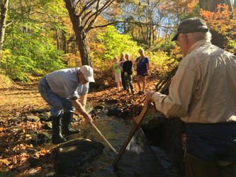
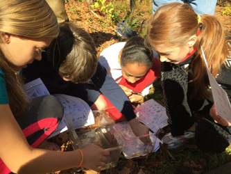
Housatonic and Naugatuck Watershed Trout Stocking and Stream Improvement
Photos courtesy of Trout Unlimited
Trout Unlimited volunteers were joined by 5th graders and their teachers from the local elementary school to plant native trees and shrubs and conduct a macroinvertebrate study.
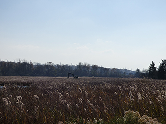
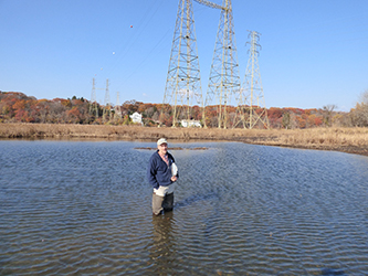
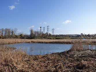
Power Line Marsh Project
Photos courtesy of Kristina Snurkowski
The CT DEEP WHAMM Unit's low ground pressure excavators are busy creating shallow pools for wildlife on the Power Line Marsh.
Pools created for wildlife use are a tenth to a quarter-acre in size and average 6-18 inches deep.
A finished pool created for wildlife use. Excavated material is pushed to an upland edge or spread and groomed on the adjacent marsh which revegetates in one to two growing seasons.
Salmon Creek/Housatonic River Land Protection
Photos courtesy of TTOR and Salisbury Association Land Trust
The 77-acre Shady Maple Farm in Salisbury was protected by the Trustees of Reservations, the Nature Conservancy and a number of other partners with partial funding from the Trustees.

The Nature Conservancy and the Salisbury Association Land Trust completed the purchase of a conservation restriction on a 22-acre parcel of riverfront land in Salisbury, Over a quarter of a mile of riverfront and river bottom were protected with the purchase.
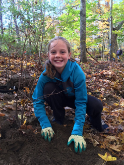
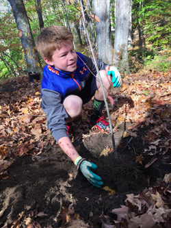
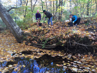
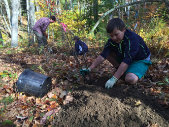
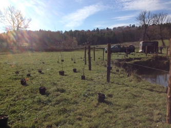
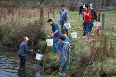
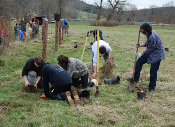
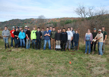
Salmon Kill Restoration and Enhancement
Twenty students from Housatonic Valley Regional High School planted more than 140 shrubs and saplings as part of the Trout Unlimited (TU) project to restore riparian habitat on the Salmon Kill River. TU hopes to rehabilitate floodplain forest and riparian forested habitat, restore eroded stream banks, and enhance in-stream habitat to benefit native brook trout and wild brown trout populations. All photos courtesy of Trout Unlimited.
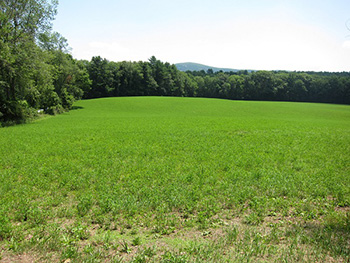
Area before planting.
A bucket brigade to water the plants.
Students hard at work planting!
Group photo of the student volunteers.
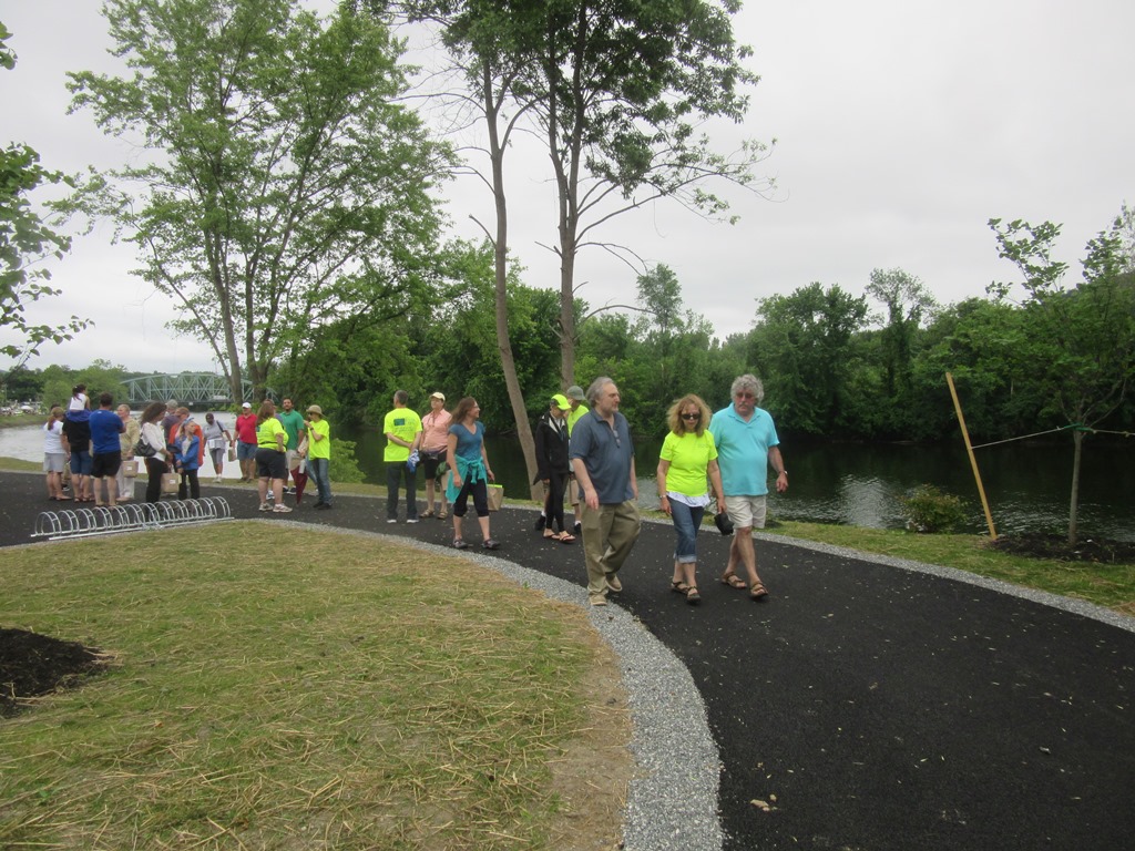
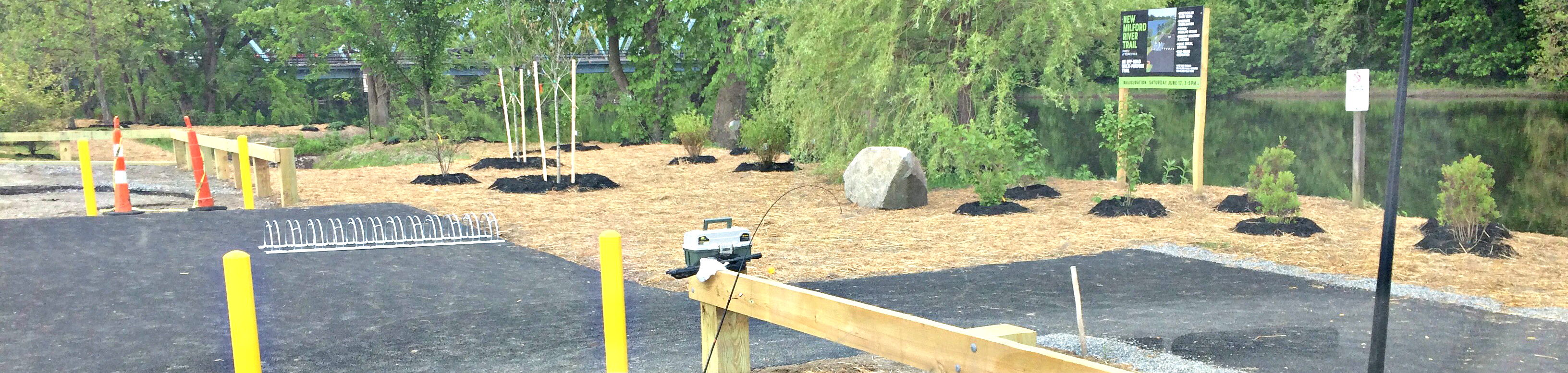
Sega Meadows Park River Enhancement
Photos courtesy of Town of New Milford and USFWS
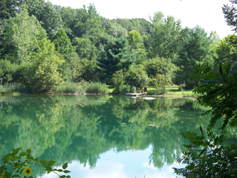
Pond at Sega Meadows after treating invasive phragmites.
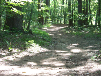
Trail at Sega Meadows.
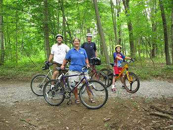
The new bike path at Sega Meadows Park is popular for cyclists.
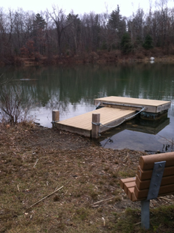
Dock at Sega Meadows.
Wimisink Preserve Restoration and Access
Photos courtesy of Dennis Larkin
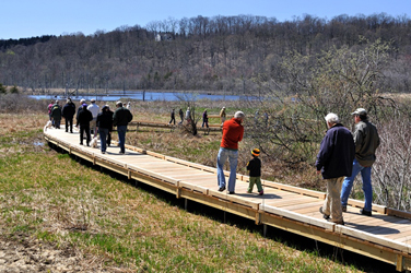
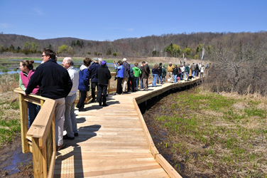
Wimisink Preserve Boardwalk, Sherman, CT.
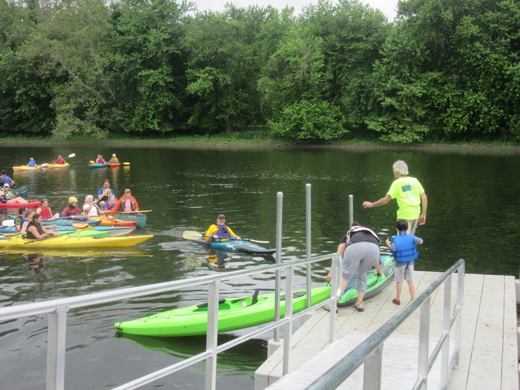
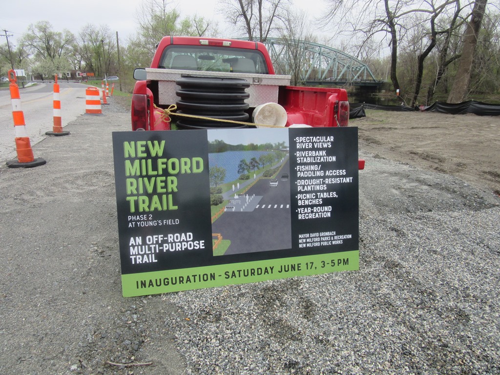
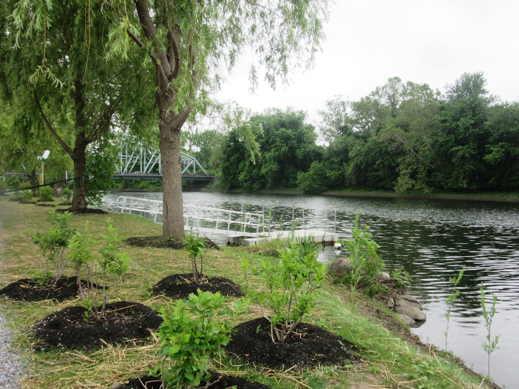
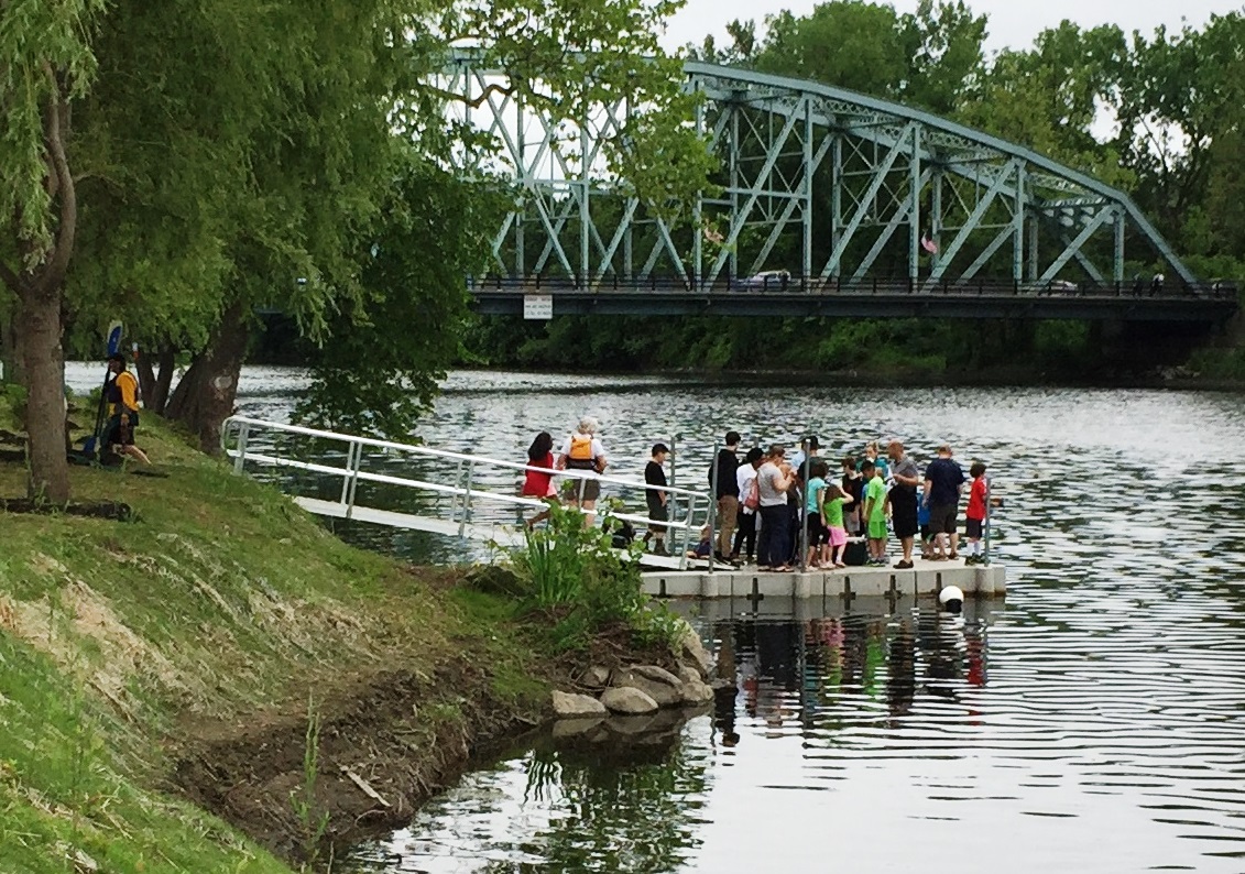
Youngsfield Park Riverwalk and Greenway
Photos courtesy of Molly Sperduto, USFWS and Dan Stanton, Town of Milford.
Riverwalk at Youngsfield Park, New Milford, CT.

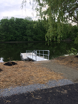
River dock at Youngsfield Park.
Residents kayaking and enjoying the boat launch at Youngsfield Park.
Celebratory trail sign before it was set up at Youngsfield Park.
Plantings by the boat launch at Youngsfield Park.
Residents who attended the celebration event enjoying the view from the pier at Youngsfield Park.
Walkers using the trail at Youngsfield Park.
Riverwalk plantings at Youngsfield Park.
Content last updated on May 11, 2018.