About The Connecticut Geological Survey
Contact us by emailOur State Geologist- Meghan Seremet, PG
The State Geological and Natural History Survey was established in 1903 by the CT Legislature (CGS Ch462) The Connecticut Geological Survey is a non-regulatory entity, dedicated to serving the geoscience information and mapping needs of the Connecticut Department of Energy & Environmental Protection and the public.
The Connecticut Geological Survey Program is coordinated by Meghan Seremet, State Geologist. The program currently includes part-time staff, graduate students, and volunteers [Survey Staff]. The Survey maintains its original mission: the promotion of scientific inquiry, economics, and geoscience education for the State of Connecticut.
The Survey compiles geoscience information, provides mapping services, and develops interpretive maps and reports for use in environmental policy, resource management, hazards mitigation, and educational outreach.
The CT Geological Survey works cooperatively with State Colleges and Universities, State and Federal Agencies, Municipalities, and Professional Organizations to meet the geoscience information and mapping needs of DEEP and the public. The CT Geological Survey supports graduate research and applied geologic mapping through University partnerships.
| Primary Funding Agencies Include: | Primary Cooperators: |
|---|---|
| U.S. Geological Survey | Association of American State Geologists |
| National Cooperative Geologic Mapping Program | University of Connecticut |
| National Geological & Geophysical Preservation | Massachusetts Geological Survey |
| National Earthquake Hazards Reduction Program | Central Connecticut State University |
| DOE/AASG National Geothermal Data System | Eastern Connecticut State University |
| U.S. FHWA Recreation Trails Program | Northeast States Emergency Consortium (NESEC) |
Library Collection and Map Archive:
Published, open file, and unpublished materials, at Department of Energy and Environmental Protection, 79 Elm Street, Hartford, CT. Specimen collections, including rock cores, hand samples, dinosaur tracks, and soils housed in Portland. Access to Survey library materials and collections by appointment.
Dr. Randolph Steinen, Curator (860) 418-5931 (randolph.steinen@ct.gov)
Meghan Seremet, State Geologist (860) 424-3583 (meghan.seremet@ct.gov)
The Connecticut Geological Survey is located at the Department of Energy and Environmental Protection, 79 Elm Street, Hartford, CT 06106. deep.ctgeosurvey@ct.gov or 860-424-3583.
Geological Survey Mapping and Data is the basis for:
-
DEEP Environmental Quality Decisions
-
Remediation Assessments
-
Ecoregion Mapping
-
Hazards Assessment
-
Land Acquisition Reviews
-
Resources for Environmental Science Educators & Science Museums
-
Geological Resource Assessments
-
Academic Research and Geosciences Advancement
-
Digital Geologic Data for DEEP GIS data server and DEEP/UConn CT ECO Internet Mapping
Geological Survey Staff work with numerous divisions within DEEP, especially: Parks/Boating, Land Acquisition, Aquifer Protection, Remediation, and Fisheries. Outside of DEEP, staff also work with:
-
University Cooperators and Students
-
US Geological Survey (Water Science Center; Branch of Geophysics; National Cooperative Mapping)
-
Natural Resources Conservation Service (CT Soils Program)
-
Association of American State Geologists;
-
Northeast State Geologists
-
Multidisciplinary Advisory Groups- Geologic Mapping; Collections; Geographic Names
-
Professional Societies- Geological Society of America; Geological Society of Connecticut
-
CT Environmental Review Team
Connecticut State Geologist's Responsibilities
-
Supervise the State Geological Survey, a Statewide Program, coordinate all aspects of the program and activities, including program plans, develop funding sources, draft cooperative agreements, budget, and create innovative partnerships for research and mapping to serve the geoscience information needs of the State and the Agency.
-
Develop and implement interagency State and Federal Cooperative mapping and research programs. Prepare, submit, and administer Federal grant applications.
-
Supervise and coordinate staff, including the work of temporary & permanent staff, numerous volunteers, student interns, and contractors. Recruit Geological Survey Research Associates for academic sabbatical research and educational program development.
-
Facilitate student development through involvement in applied geologic research and mapping to support the State Geological Survey mission and geologic data needs of Environmental Protection initiatives. Provide Connecticut geoscience information educational support to schools. Serve on graduate research and thesis committees. Support promotion and tenure of academic partners.
-
Implement and manage data preservation initiative. Support State Geological Survey data preservation efforts, by securing funding, housing, and rescue of the State Core Repository, and the Geological Survey Collections. Coordinate stakeholders group to craft long-range data preservation plan. Provide access to Geological Survey collections for research and education.
-
Engage external stakeholder groups such as the Data Preservation Advisory Committee, the State Mapping Advisory Committee, and others for input in State Survey priorities. Chair the State Geographic Names Authority. Serve as elected to The Geological Society of Connecticut Board of Directors.
-
Support the Association of American State Geologists, as a member. Advocate for the advancement of geoscience mapping and research to meet the societal needs of Connecticut and the Nation. Participate in Interstate research related to New England Geologic Hazards, Geothermal Energy, and other issues of common concern.
-
Coordinate field studies to enhance the Connecticut Geologic Sites Database and improve data quality.
-
Pursue geohydrological and geochemical research to help establish natural versus anthropogenic ground water conditions. Provide mapping of geochemical constituents of environmental concern.
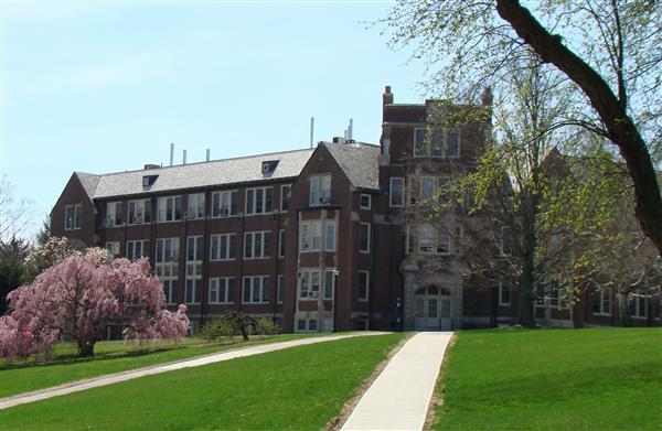
Please visit the State Geological Survey Office at the University of Connecticut Main Campus, Storrs. The goal of the office is to engage students in collaborative research initiatives in applied geologic and environmental research in Connecticut. The primary Survey office at UConn is located in Beach Hall at the Department of Geosciences. The Survey field office is located at the Water Resources Field Station, in the Horsebarn Hill Sciences Complex.

Content last updated March 6, 2023


