
Letterboxing Clues for People's State Forest
Connecticut State Forests - Seedling Letterbox Series - Clues for People's State Forest
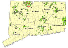
| State Map | State Forest | Letter Box Stamp |
|---|---|---|
|
People's State Forest -
|
 |
People’s State Forest covers a little over 3,000 acres in Barkhamsted and Hartland, on the east side of the Farmington River. The suggestion for a “People’s Forest” was made by Alain White in 1923, then president of the Connecticut Forest and Park Association. Much of the Forest was given to the State largely through contributions by individuals, organizations, and civic groups. In October 1924, the Forest was dedicated with a grand pageant on the banks of the Farmington River with Governor Templeton and 3,000 people in attendance.
Most of the recreational improvements such as roads, trails, and the Stone Museum were built by the Civilian Conservation Corps during the 1930s. For example, the Stone Museum first opened in 1934, and its interior woodwork is made of chestnut salvaged from trees killed by the chestnut blight. The Forest is managed for sawtimber, firewood, wildlife habitat, and recreational activities such as hiking, hunting, fishing, bird watching, and snowmobiling.
Description: The letterbox is off of Greenwoods Road (a state forest road). The nearest town road is Park Road in Barkhamsted. Estimated time for round trip from the parking area on Greenwoods Road is 30 minutes, longer if you linger at the two overlooks on this adventure.
Clues: From Hartford, take Rt. 44 west toward Winsted. Just past the town of New Hartford, turn right on Rt. 181, and follow for 1 mile to the intersection of Rt. 318 in the hamlet of Pleasant Valley. Turn right on Rts. 318/181 and cross the Farmington River. Stay on Rt. 181 for 1.1 miles to Park Road. Turn left on Park Road. Continue for 3.4 miles to Greenwoods Road and turn left. There is a brown and yellow sign at the entrance. During the winter, Greenwoods Road is closed to traffic and is part of the snowmobile trail in the Forest.
From the entrance, follow Greenwoods Road for 0.5 miles to a sign for the Jessie Gerard Trail on the right side of the road. Park at the trail head. The trail is named after the woman who led the Connecticut Federation of Garden Clubs in the 1920s, one of the civic groups that helped raise money to buy this Forest. The trail is marked with yellow dots on blue blazes. It is maintained by members of the Connecticut Forest and Park Association (http://www.ctwoodlands.org). This section of trail is also part of the official snowmobile trail system.
Hike down the Gerard Trail until you come to a fork. Take the left fork - following the blue and yellow blazes. Eventually you will pass between two huge boulders - called the Veeder Boulders - named after Curtis Veeder, a CFPA member who was an early supporter of our State Forests.
As you hike along, you will go through a forest dominated by eastern hemlock. Hemlocks is being threatened by two insects that are not native to this country, the elongate scale and the woolly adelgid. These insects have been identified in People’s Forest. You will see dead and dying hemlocks as you walk along the trail. Timber harvests that occurred a few years ago on both sides of this trail have been designed to increase the abundance of other kinds of trees.
Continue along the trail until you come to an overlook. You will be looking westward across the Farmington River. The little village in the valley to the right (the north) is Riverton.
There is an informal trail registry at the overlook. Feel free to sign in.
After the overlook, continue along the trail (it bends to the left) for roughly 5 minutes until you come to another lookout. About 100 feet before this second overlook, there is a flat, arrow-shaped rock on the side of the trail. It points to a large boulder about 15 feet to the right of the trail. The letterbox is under a smaller rock that leans against this boulder. It is about 3 feet from a small hickory tree.
Continue to the second overlook. This time you are looking southward down the Farmington River Valley. The wooded slopes to your left comprise People's State Forest, and the forested hillsides to the right of the River make up American Legion State Forest.
In 1994, the 14 - mile section of the Farmington River from the Goodwin Dam in Hartland to the New Hartford - Canton town line was designated as a National Wild and Scenic River, in large part because State Forests line both sides of the River.
You can retrace your steps to Greenwoods Road. If you are adventurous, drive down Greenwoods Road for 3.2 miles to East River Road. Along the way, you will see the Big Springs and James Stocking Recreation Areas. These areas are open to youth group. Call the DEEP Western District Headquarters at 860-485-0226 for more information. You will also pass a Nature Museum, open on weekends during the summer and early fall. When you reach East River Road, turn left, and in about 1 mile you will come out on Rt. 181. Turn right on 181, and you will cross the Farmington River at Pleasant Valley.
Learn more, earn a patch: Your walk has taken you to a Forest that was made possible by the enormous generosity of the people of Connecticut.
This is one of 32 letterbox hikes that will be sponsored by the Connecticut Department of Energy and Environmental Protection’s Division of Forestry. When you have completed 5 of these sponsored letterbox hikes, you are eligible to earn a commemorative State Forest Centennial patch. Contact DEEP Forestry
Content last reviewed September 13, 2021.