
Letterboxing Clues for American Legion State Forest
Connecticut State Forests - Seedling Letterbox Series Clues for American Legion State Forest
|
American Legion State Forest - |
 |
American Legion State Forest covers roughly 900 acres in the town of Barkhamsted, on the west side of the West Branch of the Farmington River. The American Legion gave most of this forest to the state. The first deed was received in 1927 and the most recent acquisition was in 2004.
The Civilian Conservation Corps established Camp White on the Forest in 1934 and the remnants are still visible in and around the present day Youth Group Camping Area. The C’s made many improvements to the forest such as building the main access road in the Forest (Legion Road), building firebreaks and trails.
The Austin F. Hawes Memorial Campground provides 30 spacious and wooded campsites near the river. In 1994, this stretch of the West Branch of the Farmington River was designated by Congress as a Wild and Scenic River, and is a center point for river-based activities.
The forest is a mosaic of forest tree species commonly found in Northwest CT. The slopes are steep, rugged and rocky. In 1922 the entire area was burned over. It was reported that the residents of Pleasant Valley started to leave their homes as they expected the village would be lost to the fire.
The Forest is managed for sawtimber, firewood, wildlife habitat, and recreational activities such as hiking, hunting, birdwatching, and camping.
Description: The Seedling Series letterbox is located along the Henry Buck Trail on an overlook approximately half way around the 2.1-mile trail. The trail has a southern and northern trailhead along West River Road about 1500 feet apart. The description to follow begins at the southern trailhead.
Clues:
In Northwest Connecticut on Rt. 44 westbound go through the center of New Hartford and turn on Rt. 181. Follow Rt. 181 for about 1 mile into the center of Pleasant Valley. You will come to a 4-way intersection. Go straight onto West River Road. The West Branch of the Farmington River will be on your right. Travel about 2.1 miles and you will pass the first entrance to Legion Road, a gravel forest road. You will have passed a state campground named for Austin Hawes. Mr. Hawes served as State Forester for 28 years in the early 1900’s and was instrumental in establishing Connecticut’s State Forest system. Travel another 0.1 miles to the second entrance of Legion Road. The southern trailhead for the Henry Buck Trail is several hundred feet beyond the second entrance. Parking is along the black top road or back onto Legion Road.
Cautions: This trail has steep inclines and descents with numerous rocky areas that are very slippery when wet or when ice is on the trail. Use caution and wear hiking boots. Another caution, if you like the out-of-doors and wildflowers in the spring, you may become addicted to this trail.
Be observant along the trail. You may see a variety of wildlife. Pileated woodpecker, moose, black bear, fox, bobcat, turkey, hawks and owls all inhabit this area. A good chance you will hear the throaty cawing sound from the ravens that nest nearby. Notice the size of the trees, especially on the lower sections. Not only are they large in diameter but also they are very tall. Height of the trees will correspond to the growing conditions. These lower slopes have very rich soils.
The beginning section of this trail is relatively easy traveling. This section is a must see to view springtime wildflowers. Plan a trip around May 1. You may notice the Youth Group Camping area on the downhill side of the trail. This area received a timber sale in the year 2000. About 28 acres was harvested to remove hemlock trees struggling with the affects of a hemlock wooly adelgid infestation and to remove hazardous trees in the Youth Group Area. Small openings have created conditions to regenerate the forest and allow visitors to have a better view into the woods.
The trail turns sharply up hill following a streambed. Notice many steps in the trail that were created when the C’s did the construction. After about ¾ of a mile, the trail somewhat levels out and you will notice an old “cellar hole” and a large stonewall just behind it. This is not a cellar hole! It is the remnants of the old cheese box factory that operated in the early 1800’s. They made wooden boxes to store and ship locally-produced cheese.
The stonewall is actually part of the foundation and the factory extended out over the ‘cellar hole’! Water was directed into what looks like a stairway into the cellar hole via a sluiceway. The water turned a paddle in this ‘cellar hole’ that was connected to a gearbox that, in turn, provided power up to the factory! The wooden sluiceway must have been in the area where the trail proceeds to an old, washed out earthen dam. The small reservoir that was created by this dam provided the water necessary to power the cheese box factory.
Please do not climb into the ‘cellar hole’ or climb the stonewall. They are beginning to cave in and the problem can be worsened by that sort of activity. Shortly after crossing the old dam you will swing up under the ledges. A large rock bench is provided and you will find a Bronze plaque, honoring Henry Buck, up on the ledge overhang.
The trail continues, you will start down a short hill and come across a lookout vista with a view to the southeast. Under a nearby rock you will find the letterbox.
Continuing on the trail just a few hundred feet you will see an area that looks ‘different’. Some of the larger hemlock trees are dead. There are many more smaller (2” to 4” in diameter) black birch trees. This area, less than ½ acre, shows the result of a forest fire that occurred about 1980. Carelessness on the part of someone started this fire.
The trail climbs a steep switch back and then levels out, and passes a series of very large boulders. As the trail begins to descend you will cross a small area, carved into the side slope, perhaps 30’ across that is perfectly flat. This is an old charcoal mound. You may find bits of old charcoal dating back to the late 1800’s if you poke around in the dirt.
Most of the hills of Northwest Connecticut were repeatedly clearcut to provide charcoal for the iron industry. Many of the cannons used during the Revolutionary War were manufactured in northwest Connecticut, using charcoal to fuel the furnaces. Later charcoal was used in the brass industry along the Naugatuck River valley.
The trail continues down to the northern trailhead and the paved road. It is but a short hike back to your car. Watch the river and skies overhead as you may see bald eagles soaring.
Learn more, earn a patch: Your walk has taken you through a forest whose protection was made possible by the enormous generosity of the American Legion. The initial 213 acres of this forest was a gift of the American Legion in 1927 to provide citizens an example of proper forest management as observed by U.S. soldiers throughout Europe during World War I. Under good stewardship practices, the Division of Forestry manages the State Forests to provide wood as a renewable resource, improve wildlife habitat, protect our water, and provides for quality recreation. Our forests are worth protecting and worth managing to insure their future and ours.
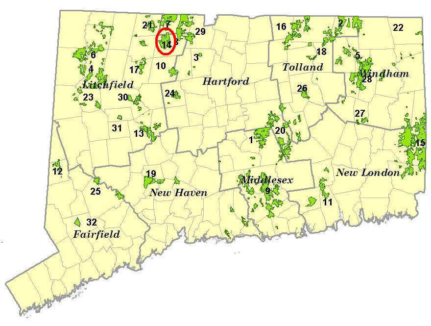
This is one of 32 letterbox hikes that is being sponsored by the Connecticut Department of Energy and Environmental Protection’s Division of Forestry. When you have completed 5 of these sponsored letterbox hikes, you are eligible to earn a commemorative State Forest Centennial patch.
When you have completed five hikes, please contact us and let us know what sites you have visited, what your stamp looks like and how we may send you your patch. We will verify your visits and send the patch along to you. Contact DEEP Forestry
Content last reviewed January 2020