
Letterboxing Clues for Algonquin State Forest
Connecticut State Forests Seedling Letterbox Series - Clues for Algonquin State Forest
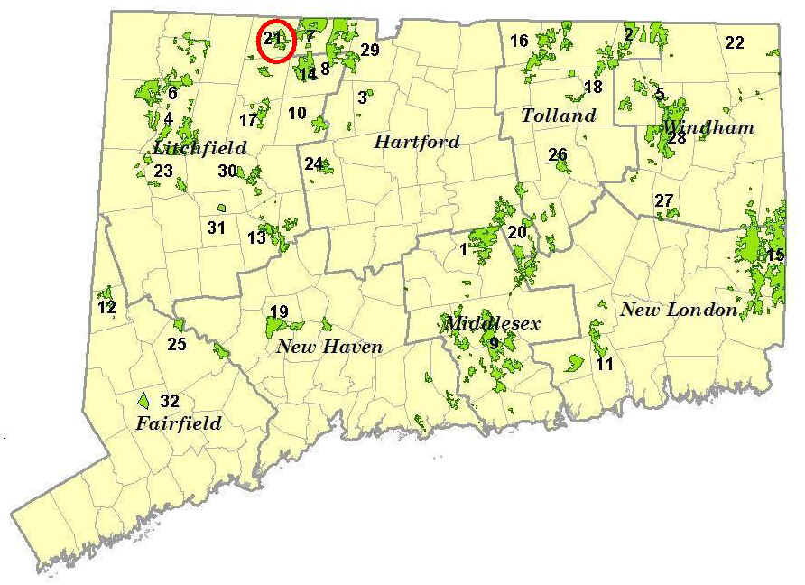
| Location Map | State Forest Information | Letterbox Stamp |
|---|---|---|
|
Algonquin State Forest – the 21st State Forest |

|
Algonquin State Forest began as 92 acres in 1937, and has grown to a size of 2,545 acres today. The forest consists of several parcels in the towns of Colebrook and Winchester. The largest piece of the forest is along Sandy Brook in Colebrook. Most of the early acquisitions of Algonquin State Forest were gifts to the State. The name 'Algonquin' is an Indian name.
The forest is managed for sawtimber, firewood, wildlife habitat, and recreational activities such as hiking, hunting, fishing, and bird watching.
To find this letterbox you will need to know how to figure distance by pacing. A good place to start would be to figure how many paces you take in 100 feet. A pace can be counted as one step or, as it is in forestry, as two steps. For a forester, one pace is measured from the heel of one foot to the heel of the same foot in the next stride. Whether you count your pace as a single step (one foot to the next) or as every two steps (one foot back to the same foot) does not really matter, as long as you are consistent. To learn your pacing, first measure a 100’ distance on the ground. Walk this distance at a comfortable pace for yourself, taking “normal” steps. Count the number of paces it takes to walk the 100’. Repeat this several times to figure your average pace for 100’. Now that you know your pace, you are all set to find the letterbox.
Description: The letterbox is located off the minimally maintained gravel portion of Simons Pond Road in the town of Colebrook. The walk is about three-fourths of a mile round trip along a gravel road with one hill to climb. It should take about 30 minutes.
Clues: From Winsted take Route 8 north to Colebrook. Just after you cross the town line, turn left onto Deer Hill Road and proceed up the road. Continue straight after the stop sign for a short distance and then turn right onto Smith Hill Road (Follow the signs for the Sandy Brook Road detour). At the stop sign in the center of Colebrook turn right onto Route 183. Continue on Route 183 until you reach Sandy Brook Road. Turn right and travel down Sandy Brook Road until you find a road named after a tree. Turn left on that road, cross the brook and continue up the hill. Turn left on Simons Pond Road. At the intersection of Cobb City Road, continue straight. Park on the paved portion of Simons Pond Road between Cobb City Road and the house.
Continue on the gravel portion of Simons Pond Road. At first, the property on both sides of the road is private. As you walk up the hill you will see tubing attached to the trees. This tubing is used to collect sap from sugar maples in order to make maple syrup. Half way up the hill you will see State tags on the right side of the road marking the property corner. A little way further on the left will be another property corner. From this point on it is State property on both sides of the road.
On the left you may see evidence of a timber harvest (tree stumps, and young growth). This area was part of a timber harvest designed to initiate uneven-aged management on this section of the forest. In uneven-aged management, trees are removed on a regular cycle to regenerate the area. This will result in a forest composed of several different age classes existing at the same time.
At the top of the hill, after you finish rounding the corner, you will see a stone wall on your left. The wall follows the road. Continue along the road past the first break in the wall, where you will see a forest road to your left. This road was used as the main skid trail for the timber harvest. It is now blocked with stones to prevent unauthorized vehicle access to the forest and it was also seeded with a mixture of grasses to prevent any erosion of the roadbed.
At the second break in the wall turn left and start up the forest road. When you reach the wall, look to your right, where you will see an old stone foundation. See how long the house has been gone; there are several larger trees growing out of the cellar.
Continue to walk up this road 145’ (remember your pacing!) from Simon's Pond Road to a sugar maple that is 11” in diameter, or as a forester would say, 11” DBH (diameter breast height). Foresters measure the diameter of a tree at a point on the tree that is 4.5’ above the ground. Just behind the sugar maple is a stone wall.
Look at the base of the stone wall for the letterbox.
As you look around the harvest area you will see piles of tops and wood pieces left on the ground. This debris is called slash and has many beneficial values. The woody material becomes infested with fungi and insects. It offers shelter, food, and nesting sites for species such as salamanders, snakes, mice, chipmunks, songbirds, skunks, and bears. Larger pieces provide cover for deer and may be used as drumming sites by grouse. As decomposition of this material progresses, nutrients are returned to the soil. Slash also protects young seedlings from browsing by deer, which helps them become established.
If you wander around the harvest area you will find new seedlings or regeneration consisting of species such as cherry, maple, oak, and pine. The openings in the canopy created by this harvest let additional light reach the forest floor. This will help increase the growth of these seedlings so they may become part of the next forest.
Learn more, earn a patch: Due to remote location and poor access (even by foot), rugged terrain, and deed restrictions, less than 40% of the Algonquin Forest is actively managed by the Connecticut DEEP Division of Forestry. Because of some of the unique features of the forest, two portions of Algonquin have received special recognition from the State. These are the Sandy Brook Natural Area Preserve and the Kitchel Wilderness Natural Area Preserve, both of which are in the vicinity of Sandy Brook Road.
This is one of 32 letterbox hikes sponsored by the Connecticut Department of Energy and Environmental Protection’s Division of Forestry. Take 4 additional sponsored letterbox hikes to earn a commemorative State Forest Centennial patch
When you have completed the five hikes, please contact us and let us know what sites you have visited, what your stamp looks like and how we may send you your patch. We will verify your visits and send the patch along to you. Contact DEEP Forestry
Content last reviewed September 13, 2021