Long Island Sound
Water Quality and Hypoxia Monitoring Program
Results and Annual Reports

LIS Monitoring Surveys
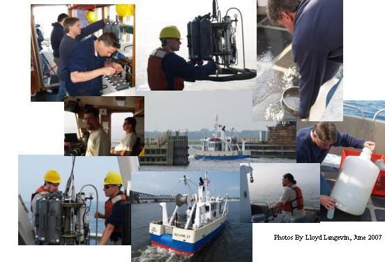
The summer Long Island Sound water quality sampling schedule includes routine water quality surveys as well as summer-only hypoxia surveys.Routine water quality surveys are conducted year-round, including during the summer months. During these surveys water samples are collected from 17 stations and analyzed for nutrients and other water quality parameters. In addition, phytoplankton and zooplankton samples are collected from 6 stations in the Sound.
Hypoxia surveys are conducted during the months of June through September at an additional 30 stations. During hypoxia surveys, stations are sampled for dissolved oxygen to get a more accurate understanding of the extent of summer hypoxia conditions in Long Island Sound bottom waters.
DEEP's Long Island Sound Water Quality Monitoring Program utilizes data from both surveys to monitor the extent of low dissolved oxygen in Long Island Sound bottom waters, or 'summertime hypoxia'. Hypoxia condition maps are posted as soon as possible after each survey.
Monitoring Schedule
Monitoring Results
This year's monitoring results are reported in the survey summaries and hypoxia maps below.
Survey Summary Newsletters:
- September 2025 Water Quality Survey (WQSEP25) Summary (Vol. 8, Issue 8)
- August 2025 Water Quality Survey (HYAUG25) Summary (Vol. 8, Issue 7)
- August 2025 Water Quality Survey (WQAUG25) Summary (Vol. 8, Issue 6)
- July 2025 Hypoxia Survey (HYJUL25) Summary (Vol. 8, Issue 5)
- July 2025 Water Quality Survey (WQJUL25) Summary (Vol. 8, Issue 4)
- June 2025 Hypoxia Survey (HYJUN25) Summary (Vol. 8, Issue 3)
- June 2025 Water Quality Survey (WQJUN25) Summary (Vol. 8, Issue 2)
- Long Island Sound 2024 Algal Bloom Summary (Vol. 8, Issue 1)
Dissolved Oxygen Distribution/Hypoxia Extent Maps:
- September 2025 Water Quality Survey (WQSEP25) Map - August 25 - 28, 2025
- August 2025 Hypoxia Survey (HYAUG25) Map - August 11 - 13, 2025
- August 2025 Water Quality Survey (WQAUG25) Map - July 29 - 31, 2025
- July 2025 Hypoxia Survey (HYJUL25) Map - July 14-16, 2025
- July 2025 Water Quality Survey (WQJUL25) Map - June 30 - July 2, 2025
- June 2025 Hypoxia Survey (HYJUN25) Map - June 17 -18, 2025
- June 2025 Water Quality Survey (WQJUN25) Map - June 2 - 4, 2025
Dissolved Oxygen Distribution/Hypoxia Extent Maps Animation:
Historic Monitoring Reports & Maps

Water Quality and Hypoxia Monitoring Program

