
Hypoxia Maps - Summer 2007
Dissolved Oxygen Maps for Summer 2007
During the summer of 2007, DEP's Long Island Sound Water Quality Monitoring Program continues to monitor the extent of summertime hypoxia. The Program collects samples for nutrient analysis and water quality parameters from 17 stations, as well as phytoplankton and zooplankton samples from 6 stations located throughout the Sound. An additional 20 – 30 sites are sampled during the summer for dissolved oxygen to get a more accurate idea of the extent of hypoxia.
Maps showing the extent of low dissolved oxygen in Long Island Sound are posted as soon as possible after each survey.
(Select map below to link to a larger image)
 September 10, 2007 |
||
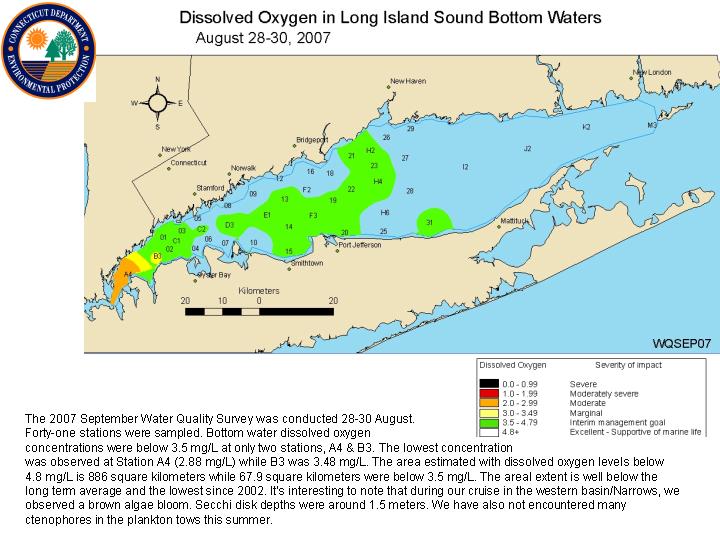 August 28-30, 2007
|
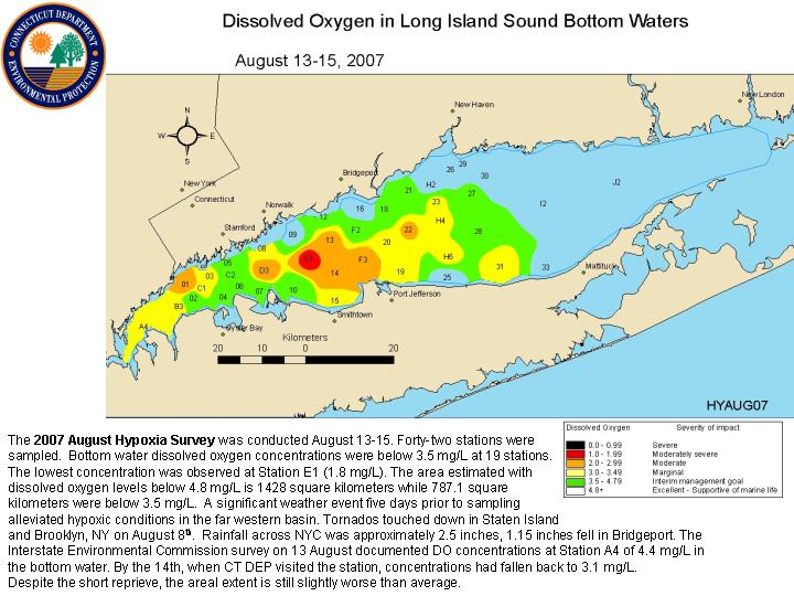 August 13-15, 2007 |
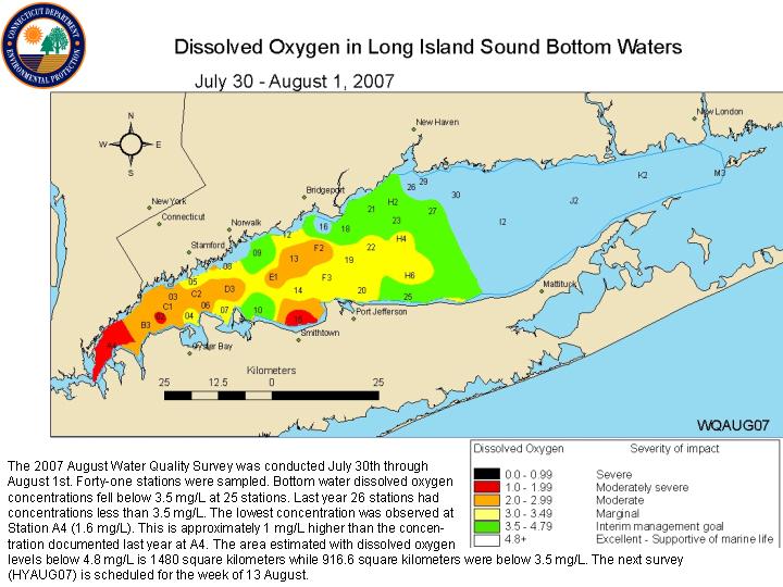 July 30 - August 1, 2007 |
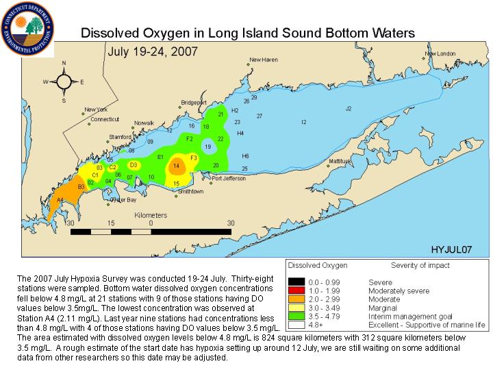 July 19-24, 2007 |
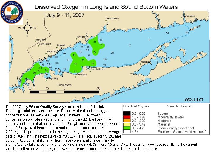 July 9-11, 2007 |
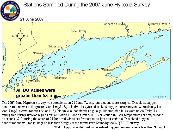 June 21, 2007
|
Water temperature plays a major role in the timing and severity of the summer hypoxia event. The DEP's monitoring program also records water temperatures and salinity during its hypoxia monitoring cruises to help estimate the extent of favorable conditions for the onset, extent, and ending of hypoxia.