
Hypoxia Maps - Summer 2006
Dissolved Oxygen Maps for Summer 2006
During the summer of 2006, the Long Island Sound Water Quality Monitoring Program will continue monitoring the extent of summertime hypoxia. The Program collects samples for nutrient analysis and water quality parameters from 17 stations, as well as phytoplankton and zooplankton samples from 6 stations located throughout the Sound. An additional 20 – 30 sites are sampled during the summer for dissolved oxygen to get a more accurate idea of the extent of hypoxia.
Maps showing the extent of low dissolved oxygen in Long Island Sound are posted as soon as possible after each survey.
(Select map below to link to a larger image)
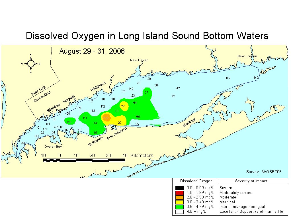 August 29-31, 2006 |
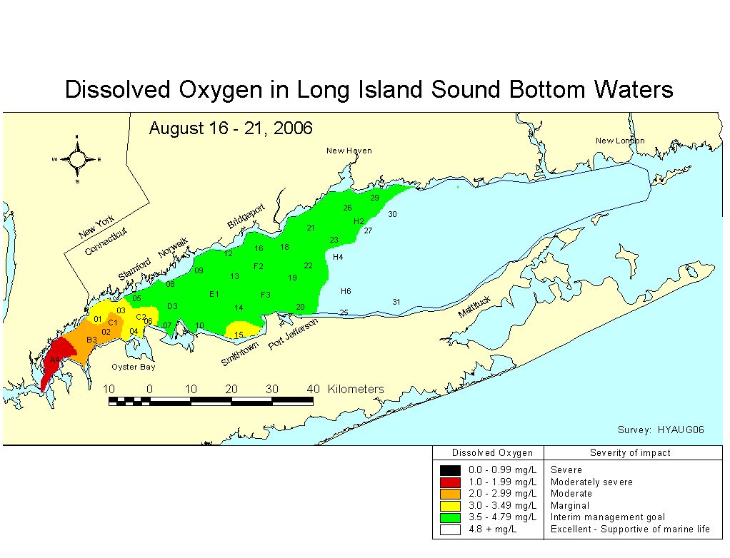 August 16-21, 2006 |
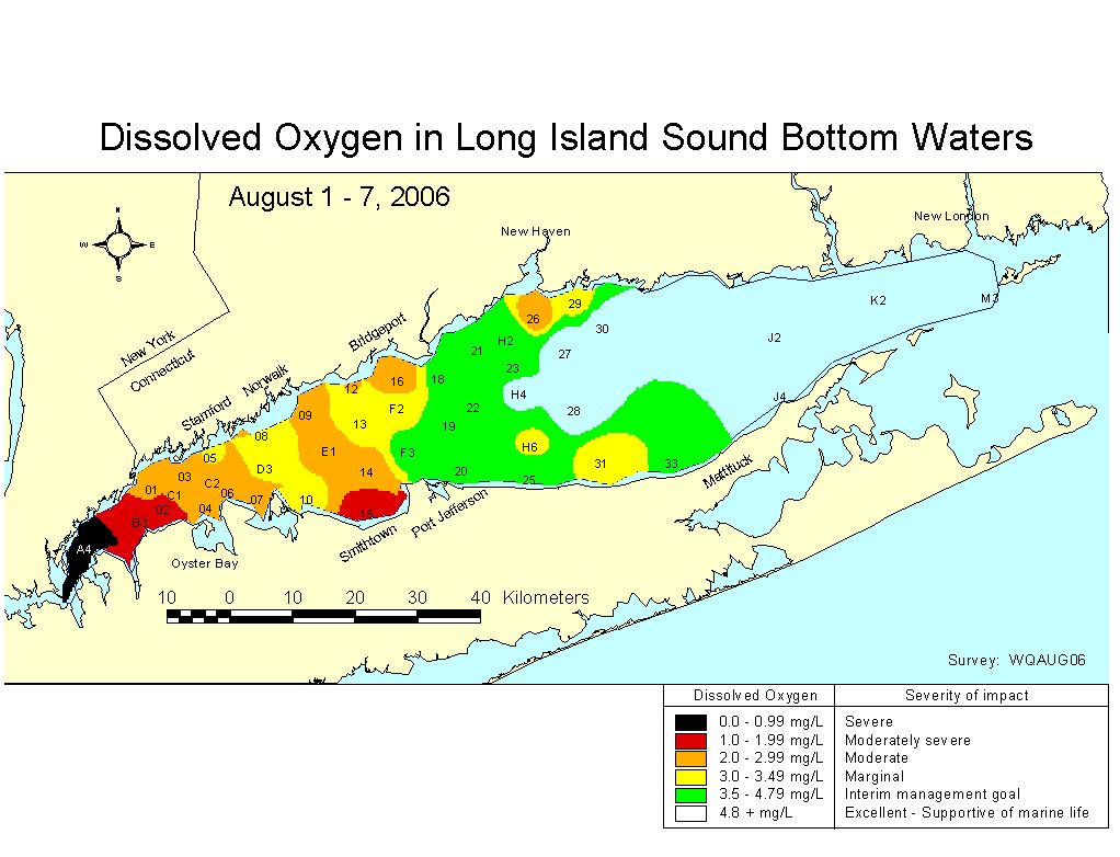 August 1 - 7, 2006 |
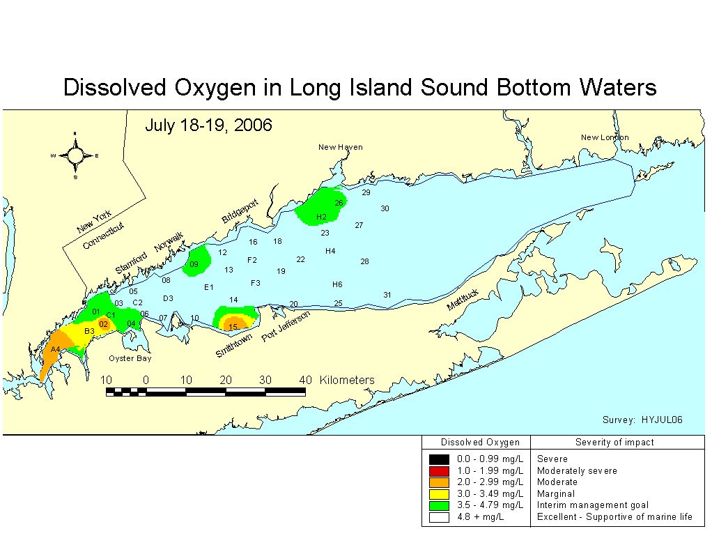 July 18-19, 2006 July 18-19, 2006 | ||
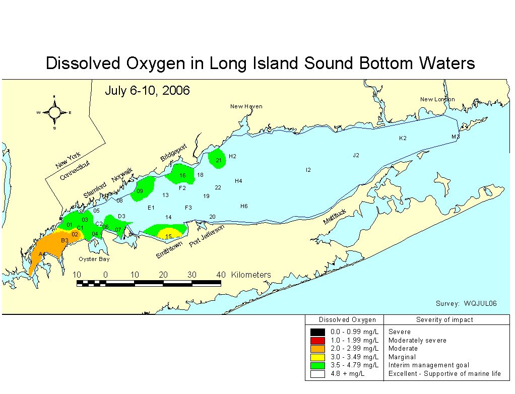 July 6-10, 2006 July 6-10, 2006 |
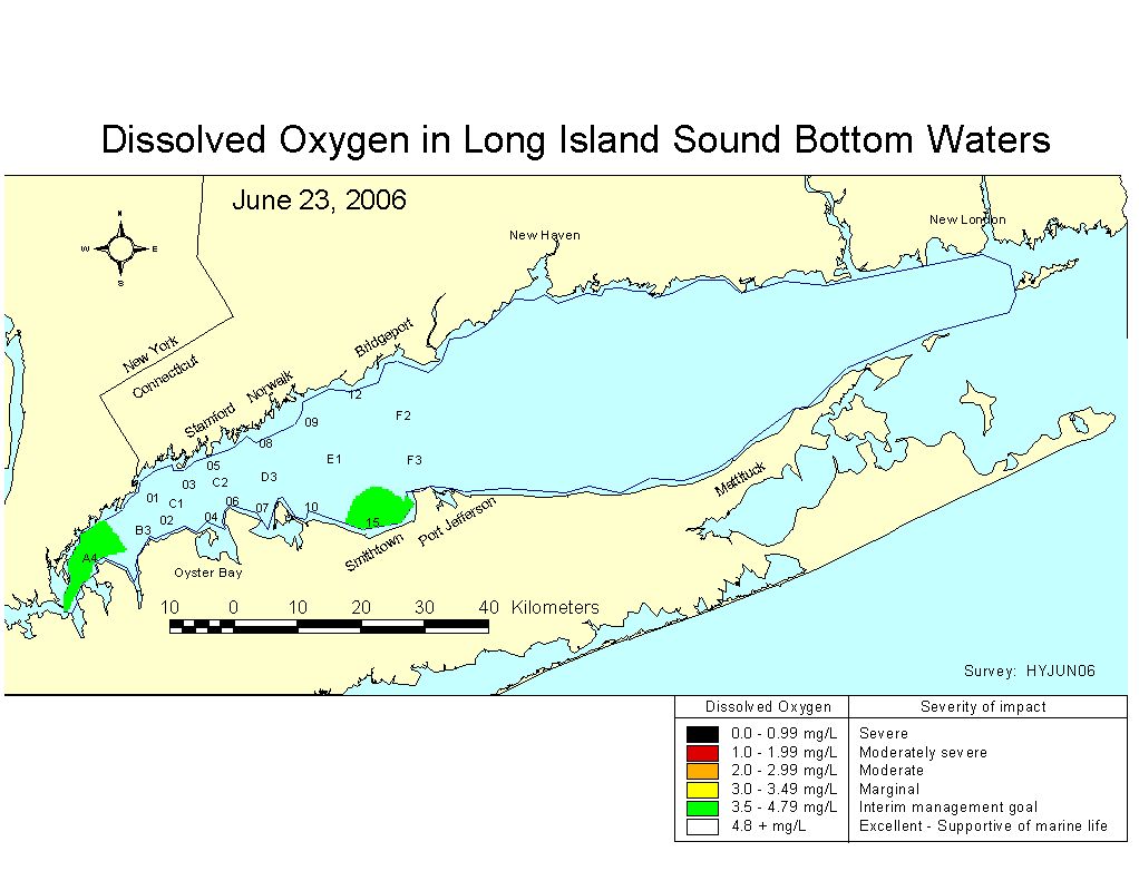 June 23, 2006 | ||
Long Island Sound Water Quality Monitoring