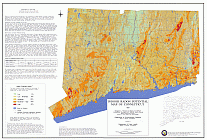
Radon Potential Map
 An Indoor Radon Potential Map of Connecticut was published by the Connecticut Geological and Natural History Survey at the end of 1997. Radon potential ratings are derived from a computerized spatial analysis of bedrock geology, surficial materials, and surface radioactivity mapping, with indoor air and bedrock well water radon data.
This map is intended for planning purposes and is not suitable for site specific analyses.
The radon data includes 4721 homes and 958 bedrock wells tested for radon statewide between the years 1985-1995. The testing was conducted by the Connecticut Department of Environmental Protection, Department of Public Health, United States Geological Survey, University of Connecticut, and the Stamford Health Department. Radon measurements have been correlated with geological and geophysical factors enabling the mapping of radon potential across the state.
The first page depicts average potential radon levels throughout the entire state with a color legend. The second page shows a comparison of surface radiation, surficial materials, and bedrock geology scores with average indoor radon.
Radon Potential Map (.gif)
Radon Potential Map (PDF) Please note: This map is a large file and may take some time to view. It is printable only on E (plotter) size paper.
For more information on radon, please visit the Department of Public Health (DPH) Radon Program.

