
Letterboxing Clues for Shenipsit State Forest
Connecticut State Forests - Seedling Letterbox Series Clues for Shenipsit State Forest
| Location Map | State Forest Information | Letterbox Stamp |
|---|---|---|
|
|
Shenipsit State Forest – |
|
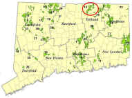
Shenipsit State Forest was initiated in 1927 with the purchase of land at the summit of Soapstone Mountain in Somers to erect a fire tower. The fire tower was removed in 1971, but the forest has been expanded over the years to about 7,000 acres in Ellington, Somers and Stafford.
Shenipsit is dominated by nearly pure stands of oak, particularly red oak, as a result of repeated clear-cutting for charcoal production and as a result of fire. All of this occurred prior to State ownership. Oak reproduction is favored by clear-cutting and by fire, as clear-cutting creates the open, full-sunlight conditions oak seedlings need to keep growing. Also, oak seedlings and saplings almost always re-sprout from the root collar and grow vigorously after the above-ground part of the tree has been killed by fire or through cutting. Oak trees produce valuable timber as well as important wildlife food – acorns are an important source of nutrition for deer, turkey, squirrels and other wildlife.
At the time of acquisition, from the fire tower the forest presented the appearance of a checkerboard. Some of the areas were dominated by young sprouts, others by saplings; but hardly any of the forest was of such as size as to be considered timber. That is why it is hard to find much evidence of the 1938 hurricane in Shenipsit. This is in contrast to Nipmuck, only a few miles to the east. The trees in Shenipsit were still young and not tall enough in 1938 to be greatly affected by the storm, while many acres of the older, larger trees in Nipmuck were blown over or broken.
The early work in Shenipsit was to open a woods road and build the fire tower. In 1935 Civilian Conservation Corps Camp Conner was established at the present site of the Forest Headquarters and CCC Museum. The CCC crews built roads, located boundaries, planted trees and thinned the forest for firewood until 1941, when the United States entered World War II. After the war, small crews of state workers maintained roads, thinned and pruned plantations, and thinned firewood. Since the mid-1980’s, the DEEP’s Forestry and Parks Divisions have actively managed the forest for wood products, oak regeneration, and a variety of recreational pursuits.
Additional information can be obtained at the forest headquarters located on Route 190 in West Stafford.
Description: The letterbox lies off the Shenipsit Trail – part of the Blue Trail system maintained by the Connecticut Forest and Park Association. It is in the Bald Mountain Block of Shenipsit, which is the part of the forest north of State Route 190. The hike to the letterbox is about ½ mile, so the round trip is about a mile, but if you prefer not to backtrack you can hike a loop that is of a little over a mile and a half in length. Wearing bright orange during deer firearm hunting season (November and December) is strongly encouraged.
Clues: On State Route 190 in Stafford about 1,000’ east of the Stafford/Somers town line, turn north onto Galbraith Road. About a thousand feet up the road you’ll see a State Forest sign at a gravel forest road (Avery Road) entrance into the forest. Park in the small parking area by the gate. After you walk north about 350’ on Avery Road, the trail heads west on flat ground in a mixed hardwood stand. This stand had a first-phase shelterwood harvest in 1994. (A shelterwood harvest is a form of forest harvest and regeneration in which the matures tree are removed in phases (usually two or three phases) so as to provide partial sun to the forest floor while the regenerating trees become established).
After about 400’ on the flat ground the trail starts uphill, goes past a stone wall on the left (south), and then starts downhill. Notice the stone waterbars installed on the slope to divert water off the trail and prevent erosion. (After you cross Lievre Brook and start back uphill you’ll be in Somers for a few hundred feet until the trail turns to the northeast and back into Stafford. The trail was re-routed several years ago, so it probably is not shown accurately on your topo map, if you have one.) When the leaves are off the trees, Bald Mountain (elevation 1121’) will be visible to the northwest.
Be careful crossing the brook in winter. Your best bet is to cross a few feet south of the blue-blazed trees, where you can grab a 1” dbh (diameter at breast height – 4.5’ above ground level) red maple, step onto a flat rock and grab a 3” dbh yellow birch on the other side of the brook. About 25’ after crossing the brook is a large American beech tree growing on a rock on the north side of the trail. Another 70’ up the trail is a large double-stemmed tulip tree on the right side of the trail.
About 300’ after crossing the brook the trail turns to head almost due north for about 100’, then makes a slight turn to the northeast by a 6” dbh beech tree on the right side of the trail. (Note the smooth gray bark of the beech. You’ll also see two 9” dbh white pines 10’–12’ behind the beech.) About 200’ past the 6” beech the trail makes a decided turn to the northeast. Approximately 400’ after the turn to the northeast there will be a 12” dbh scarlet oak about 10’ to the left of the trail, across the trail from a 7” dbh black birch with a blue blaze. Stop and look to the north past the scarlet oak. There are two large rock outcroppings about 80’-100’ from the trail. The letterbox is located in a crack on the northeast side of the smaller rock outcrop.
Notice the different ferns, moss and lichens growing on the rock. Notice also the fair number of white pines in this stand. This amount of pine is somewhat unusual for Shenipsit. We are in the process of pruning much of this pine with pole saws. Knots in lumber are formed by tree branches. Most hardwood trees in a forest “self-prune” very well – after their lower branches get shaded out and die, they fall off fairly quickly. White pines, however, do not self-prune well, and tend to hold their dead lower branches for many years. Pruning off dead branches allows the tree to start to produce knot-free or “clear” wood in the pruned part of the tree. Especially in white pine, clear lumber has a much greater value than lumber with knots. Knots from dead branches lower the quality and value of lumber greatly, as these knots will fall out of boards sawn from the tree, leaving holes in the boards. Pruning timber trees is a long-term investment, as it usually takes a minimum of twenty-five years after pruning for a tree to grow enough clear wood to saw an appreciable amount of clear lumber from it.
But almost every part of forestry practiced properly and in a sustainable manner is a long-term investment. Trees take a long time to grow, and sustainable forestry requires always considering the long- and very long-term future. In this stand we will probably regenerate oak by doing a harvest sometime in the next 5-15 years that removes most of the hardwood trees, but that leaves most of the pine. The openings between groups of pines will be large enough to provide the full sunlight that oak seedlings and saplings need to grow. Another 50 or so years after that, pine seedlings will probably start to grow in the partial shade found under the oaks. White pine around here is best grown in partial shade when it is young, as that makes it less likely to be attacked by the white pine weevil. This weevil kills the leader of the tree, resulting in a crooked or multiple-stemmed tree. The pines we are pruning now probably won’t be harvested until about 70 years in the future. So, this stand can be managed for the long-term to be a mixture of quality pine, oak and other hardwoods.
To complete your hike you can either re-trace your steps the half-mile back to the start or walk another mile in a loop. To complete the loop, continue north on the Blue Trail until it ends, in about 1,000’ at Old County Road. Turn right (northeast) on Old County Road and walk about 1,200’ to the end of the large open marsh (out of which Lievre Brook flows). Turn right, into the pine/spruce grove, go past the picnic tables and turn right onto Avery Road to head south back to the starting point.
Learn More, Earn a Patch: Your hike has led you through two actively managed forest stands where we are growing quality wood on the best renewable natural resource in the world: trees. Not every stand in the Shenipsit State Forest is managed; some areas are left completely alone. But in those stands that are managed, we are doing our best to grow healthy, diverse stands of quality timber trees for current and future generations. The future of our country may depend on producing quality products and managing natural resources wisely.
This is one of 32 letterbox hikes sponsored by the Connecticut Department of Energy and Environmental Protection’s Division of Forestry. When you have completed five of these sponsored letterbox hikes, you are eligible to earn a commemorative State Forest Centennial patch.
When you have completed the five hikes, please contact us and let us know what sites you have visited, what your stamp looks like and how we may send you your patch. We will verify your visits and send the patch along to you. Contact DEEP Forestry
Content last reviewed February 2020