
Letterboxing Clues for Salmon River State Forest
Connecticut State Forests - Seedling Letterbox Series Clues for Salmon River State Forest
|
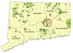
Salmon River State Forest - the 20th State Forest |
 |
Salmon River State Forest:
The first purchase for this forest was in 1934. The stated objective for owning a major portion of the Salmon River watershed was to enable the State to carry out a “long-term development program of stream improvement ….to provide a suitable environment for trout”. Subsequent purchases were made in order to improve hunting and fishing in the watershed.
The forest covers over 6,000 acres in Hebron, Colchester, East Hampton and Marlborough. Some of the features on the forest include:
- The only remaining covered bridge in eastern Connecticut. This bridge spans the Salmon River near Route 16 in East Hampton. Very picturesque.
- The Airline Trail follows the former railroad bed and features the 137-foot high Lyman Viaduct (once a 1,108 foot wooden bridge built in 1873) that was filled to the top with gravel in 1912-1913 to support the heavier trains. The “Viaduct” provides a wonderful view of the Dickenson Creek valley.
- A handicap accessible fly-fishing area and a disabled veterans fishing area. The Salmon River is also a key river for Atlantic salmon restoration, with a fish ladder at the Leesville Dam.
- Several water-powered mills once operated on the river and its tributaries, including grist, paper and sawmills.
- The first sawmill in Marlborough was built in 1751 on the Blackledge River upstream from Route 66 near the DEEP District Headquarters.
Before state ownership, the forest had been repeatedly logged and cleared for the production of charcoal. Camp Stuart, a CCC camp, operated from 1935 –1940. CCC work crews did forest improvement work that can still be seen within the forest. Today, the DEEP Forestry Division manages the forest. The Forestry Division uses scientific forestry methods to improve the forest and wildlife habitat areas, and to maintain good water quality throughout the watershed.
Description: The letterbox lies off River Road in Colchester. The hike is less than a quarter of a mile on easy terrain. A compass may be a useful tool in your search. The estimated time of the trip is less than an hour. Wearing bright orange is encouraged during hunting season (November and December). Dogs should be on a leash.
Clues: Start your journey at the junction of Route 2 and Route 149 in Colchester. Begin at the "Park and Ride" and proceed south on Route 149 for 0.7 mile. Turn right onto River Road at the water tower and go 1.2 miles to the bridge over the Blackledge River. Park your car on the right in a pull-off just before the bridge. You will be across the road from a cedar gate and brushy field. Walk past the gate into the old field, following the road heading downstream. The road gets closer to the stream the farther you go.
This section of the Blackledge River is a site of a completed habitat restoration project to control streambank erosion. A 440-foot stretch of river is now stabilized using bioengineering techniques and design principles drawn from fluvial geomorphology. Several tree and rootwad structures were installed along the streambank to provide much needed large woody debris cover habitat for the fish in the river. Deep pool habitat more than 200 feet in length was restored alongside the outside streambank. You can learn more about this project and other stream restoration projects in Connecticut by visiting the Stream Habitat Restoration Page in the Fisheries Management section of the DEEP website.
Continue to the edge of the woods. When the leaves are on the trees, the shade will be quite dark. Proceed into the forest about 50 feet. Stop at the two hemlocks between the road and the stream. A berm of dirt rises up with a large red oak on the left and a white oak on the right. While standing on the path, face the 2 hemlocks and the river. Turn 180 degrees. Do you see a large moss covered rock and a dead red oak? The rock is about 8 feet long. Go to it! (It will be about 12 paces or 70 feet away). Your prize is at the base of the hill below the Air-Line State Park Trail between the large mossy rock and the dead red oak.
You may want to explore the old railroad trestle from the Air Line Trail. More information can be found on the Air Line State Park Trail webpage.
Learn More, Earn a Patch:
State Foresters manage more than just the timber resource. They have the uncanny ability to see the forest for the trees and, also, for “looking beyond the trees”.
Oh, and one more thing. There is a solitary grave in this forest – a memorial to a soldier. It is in the forest east of Fawn Brook and just west of the corner of Slocum and Blackman Roads. The gravestone is weathering away, but you can still see the soldier’s name, the date, cause of death, and his age.
This is one of 32 letterbox hikes that are being sponsored by the Connecticut Department of Energy and Environmental Protection’s Forestry Division. When you have completed 5 of these sponsored letterbox hikes, either from this series, or the Centennial series, you are eligible to earn a commemorative State Forest Centennial patch.
When you have completed five of these hikes, please contact us and let us know what sites you have visited, what your stamp looks like, and how we may send you your patch. We will verify your visits and send the patch along to you. Contact DEEP Forestry
Content last updated in June 2025