Connecticut State Forests - Seedling Letterbox Series Clues for Pootatuck State Forest

|
Pootatuck State Forest -
|
 |
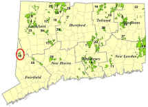
Pootatuck State Forest is about 1,050 acres. It is located primarily in New Fairfield, with a small portion in Sherman. The main block of the Forest rises steeply from the western shore of Squantz Pond. Most of the Forest was acquired in the 1920s for about $10 per acre. In the 1930s, the Civilian Conservation Corps (CCC) established a work camp at nearby Squantz Pond State Park. The CCC was very active in the Forest. They planted trees, built roads and fire ponds, salvaged dying chestnut trees for posts and poles, and did forest thinnings to produce firewood.
Today, the Forest is managed for sawtimber, firewood, and wildlife habitat, as well as recreational activities such as hiking, hunting, birdwatching, snowmobiling, and cross-country skiing.
Note: To find this letterbox, it may help you to know how to figure distance by pacing. A good place to start would be to figure how many paces you take in 100 feet. A pace can be counted as one step or, as it is in forestry, as two steps. For a forester, one pace is measured from the heel of one foot to the heel of the same foot in the next stride. Whether you count your pace as a single step (one foot to the next) or as every two steps (one foot back to the same foot) does not really matter, as long as you are consistent. To learn your pacing, first measure a 100' distance on the ground. Walk this distance at a comfortable pace for yourself, taking "normal" steps. Count the number of paces it takes to walk the 100'. Repeat this several times to figure your average pace for 100'. Now that you know your pace, you are all set to find the letterbox.
Description: The letterbox is along a trail in the Red Pine Block of the Forest. If you follow the clues, the estimated time for a round-trip hike from the parking area is 20 minutes and you will travel almost half a mile (0.5 mile).
Clues:
From Squantz Pond State Park: Drive up the hill west on Shortwoods Road. You will pass the main Block of Pootatuck to your right. After approximately 1.3 miles, Beaver Bog Road goes off to the right. Stay on Shortwoods Road and about 1,000 feet past the intersection the parking area will be on your left.
From the center of New Fairfield: (intersection of Routes 37 and 39), Take Route 39 northeast. After about 0.4 miles, turn left onto Shortwoods Road. Head north on Shortwoods Road for about 1.8 miles. The parking area will be on your right, about 1,000 feet before the intersection with Beaver Bog Road.
On the eastern side of Shortwoods Road, there is a parking area and kiosk that reads "Pootatuck Forest Red Pine".
If you face the grey metal gate and kiosk at the parking area, there is a trail to the left. (On the trail map at the kiosk, it is labeled as an unblazed trail that is approximately 0.33 miles long.) Follow this trail as it goes up the hill in a north/northeasterly direction. Along the way, you might notice trees marked with blue and orange paint. This area was thinned with the help of local firewood cutters who participate in the Forestry Divisions firewood program. The painted trees were marked to be cut but ere never harvested. You'll pass through a conifer stand made up of larch, hemlock, and white pine. This area was a conifer plantation and at one point contained a lot of red pine as well. Red pine scale, a small insect that feeds on and kills red pine, was discovered in Connecticut in 1946. It caused red pine mortality across the State and most red pine in this area was salvaged through timber sales or has died.
After about 1,000 feet from the parking area, the trail turns sharply and heads south. Measuring from the sharp turn in the trail, in about 150 feet, you will pass a wide stonewall that comes down to the trail from the right. From this wall, in 300 feet the rail passes through a gap in another stone wall and you are beginning to enter the conifer stand again. Stop here. Can you find the red pine in this area? On your right (west side of the trail) there is a red pine about 20 feet from the trail. It is the tree with two boards nailed to it about 10 feet from the ground. It has reddish scaly bark that looks different from the white pines nearby. Red pine needle clusters only contain 2 needles while white pine clusters have 5 needles.
To find the letterbox, stand on the trail in the gap of the stone wall and look to the left (or east side of the trail). There is a large 3-stemmed red oak about 40 feet from the trail touching the left (north) side of the stone wall. Look behind this oak to find the letterbox? Notice the rounded mounds on the back of the red oak. These are called burls and are made up of callus tissue created by the tree, likely in response to disease or injury.
To get back to the parking area, you can backtrack the way you came, or continue south. If you continue south, you will come to an intersection with a woods road in a few hundred feet. If you turn right, it s about 0.13 miles back to the parking area to complete the loop. If you turn left, the woods road continues farther into the Block.
Learn more, earn a patch: Your walk has taken you through a State Forest that benefited greatly from the activities of the Civilian Conservation Corps. While the CCC did tremendous work, many of their improvements have exceeded their useful life and must be refurbished if we are to keep them in good shape for future generations. For example, recent maintenance on the Fire Road included the spreading of 500 tons of gravel, and replacing deteriorating culverts and bridges.
This is one of 32 letterbox hikes is sponsored by the Connecticut Department of Environmental Energy and Protection’s Division of Forestry. When you have completed 5 of these sponsored letterbox hikes, you are eligible to earn a commemorative State Forest Centennial patch.
When you have completed five of these hikes, please contact us and let us know what sites you have visited, what your stamp looks like and how we may send you your patch. We will verify your visits and send the patch along to you. Contact DEEP Forestry
Content last updated September 9, 2021

