
Letterboxing Clues for Meshomasic State Forest
Connecticut State Forests - Seedling Letterbox Series Clues for Meshomasic State Forest
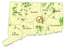
| State Map | State Forest | Letter Box Stamp |
|---|---|---|
|
|
Meshomasic State Forest - |
 |
Meshomasic State Forest began as 70 acres, acquired for $105.00 in 1903. It was the first State Forest in Connecticut and in New England, and the second in the country (Pennsylvania had the first). Meshomasic State Forest now exceeds 9,000 acres in the towns of Portland, East Hampton, Glastonbury, Marlborough, and Hebron.
The forest was originally purchased to provide private landowners with examples of good forest management practices. During the Great Depression (1930’s) two Civilian Conservation Corps (CCC) camps were located on the forest. It was the CCC who built most of the gravel roads on the forest.
Today, about 75 acres per year are harvested. This is a sustainable rate of harvest that also increases biodiversity in the forest and makes the forest more resistant to such disasters as uncontrolled wildfire and destructive insect outbreaks.
Eight miles of gravel roads are open in the forest for summer driving. The Shenipsit Blue Trail traverses the length of the forest. Rainwater from over half the forest drains into the Portland Reservoir. The largest known population of timber rattlesnakes in Connecticut is located on the forest.
Management goals include maintaining a quality supply of water for the Portland town reservoir and protection of timber rattlesnake habitat. Meshomasic State Forest also continues in its role as a showplace for proper timber management.
Additional information may be obtained at the DEEP Eastern District Headquarters on Route 66 in Marlborough (860-295-9523).
Description: The letterbox lies in the heart of the forest near the “Big Pines” plantation, the oldest State Forest plantation. The trees – white pines and Norway spruce – are over a century old. The walk to the letterbox is short, but the drive is long. The clues are intended to highlight the drive, and distances given should be within a tenth of a mile. You may want to bring along a compass, a road map with road names of the area, insect repellent in the spring and summer, and binoculars.
Clues: From just south of East Glastonbury, where Route 83 intersects Route 2 (from the bridge over Route 2), go 0.1 miles south to a stop sign. Take a left onto New London Turnpike. Proceed southeast for 0.5 miles, bearing right onto Wassuc Road. At the stop sign, turn right onto Country Club Road. After 0.4 miles take the left onto Mott Hill Road. Follow Mott Hill Road through a residential area for 0.9 mile, over a narrow stone bridge. After the pavement ends, proceed another 0.5 mile on the gravel road, entering the State Forest at the ‘Del Reeves Road’ sign.
The tree with the yellow ring around it is the forest boundary. The concrete post is the Glastonbury-East Hampton town line. Del Reeves Road is named after the first caretaker and ranger of Meshomasic Forest. Del Reeves was a true woodsman of the early 20th century who lived off the land and could handle an axe. The road winds along for 0.5 mile. You will pass a large pond made in the 1970’s as a waterfowl habitat area. Now beavers frequent the pond and sometimes flood the road during heavy rains. If the road is impassable you will have to turn back. Otherwise, from the outlet brook of the waterfowl impoundment, proceed one mile up the winding road to the yellow gate at the top of the hill.
From here, you will start your descent to the Big Pines. This plantation is in a protected valley so it did not sustain damage in any of the hurricanes of the last century. About 1 mile from the yellow gate is the junction of Del Reeves and Mulford Roads. The big pines are on your right. Bear right, going downhill about 0.2 mile to a clear running brook. The water was drinkable until the beavers moved in upstream. After finding the letterbox, you may see their handiwork, if you wander on past the letterbox about 500 feet.
Stop at the 3-way intersection just past the brook. Park your car at the “Triangle” – an area with a clump of trees and a grassy area. Look for the North Mulford Road sign and a woods road heading upstream blocked with 3 boulders. Follow the road upstream. Heading northeasterly, start measuring off about 200 feet from the three boulders. On the left is a ledge outcrop with an American beech up hill from it. Carefully look under a rotten log above the outcrop. Small diameter (approximately 1") sticks have been placed on top of the box to keep the box better hidden, please replace them before you leave. Remember, from May to October this is rattlesnake country!
The “Big Pines “ Plantation has been thinned 2 times in the past 30 years. DEEP Foresters have given it the ‘natural’ appearance of an old growth forest. There is dead wood on the ground and many standing snags. But remember, these trees were planted by John Cordella Reeves in 1906 and have been tended by many foresters since then.
Now all you have to do is follow your nose to get back home. From the “triangle”, North Mulford Road heads ‘north’ to Clark Hill Road in Glastonbury. Or, if you go back over the brook and up the hill and take a right onto Mulford Road, you will eventually get to Route 66 in East Hampton (if you have a map and take a few rights and lefts) or to route 17 in Portland. Del Reeves Road takes you north to route 2 where you began.
But, why is there a Mulford Road? (Hint: GOOGLE Walter Mulford…and you’ll find out.)
Learn more, earn a patch: The last thinning in the pines was in the early 1990’s. Several stands that you passed have also been thinned. Harvesting creates good wildlife habitat for food and cover for all our woodland species in CT.
This is one of 32 letterbox hikes that are being sponsored by the Connecticut Department of Energy and Environmental Protection’s Division of Forestry. When you have completed 5 of these sponsored letterbox hikes, either from this series, or the Centennial series, you are eligible to earn a commemorative State Forest Centennial patch.
When you have completed five of these hikes, please contact us and let us know what sites you have visited, what your stamp looks like and how we may send you your patch. We will verify your visits and send the patch along to you. Contact DEEP Forestry
Content last updated September 2019