
Letterboxing Clues for Centennial Watershed State Forest
Connecticut State Forests - Seedling Letterbox Series Clues for Centennial Watershed State Forest
| State Map | State Forest | Letter Box Stamp |
|---|---|---|
|
|
Centennial Watershed State Forest -
|
 |
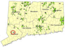
Centennial Watershed State Forest encompasses just over 15,000 acres of land. In 2002, the State, in partnership with The Nature Conservancy, acquired ownership from Aquarion Water Company of roughly 6,000 acres and also the conservation and public access easements on an additional 9,000 acres. The name “Centennial Watershed” was chosen to honor the 100-year anniversary of Connecticut's State Forest System and to recognize that one of the main purposes of the land is to protect drinking water supplies. About 90% of the land is in Fairfield County, with the rest in Litchfield, New Haven, and Hartford Counties. Management of this Forest is through a Committee consisting of representatives of Aquarion Water Company, DEEP, and The Nature Conservancy.
This State Forest is unique in that, as it is water supply land, it is regulated by the State Department of Public Health (DPH). Recreational activities traditionally found on other State Forests, such as hiking, fishing, and hunting, must receive permits from the DPH.
Description: This letterbox is continually vandalized and may not be in place on your visit. However, the site provides a picturesque view of the Saugatuck Reservoir and you are encouraged to still visit. It is located at the end of a handicapped accessible trail at the north end of Saugatuck Reservoir in the Town of Redding. In 2004, this trail, the Saugatuck Universal Access Trail, was built by the Aquarion Water Company through funds provided by the Wheels in the Woods Foundation. Estimated time for round trip is 15 minutes. Instead of a stamp, you can submit a photo of the Reservoir taken from the viewing platform.
Clues: From Danbury, take Route 53 south to the intersection with Rt. 107 in Redding. At the intersection, continue straight on Rt. 53 for 0.7 miles until you come to a “T” intersection with Newtown Turnpike. Turn left onto Newtown Turnpike. Continue for 0.1 mile. Turn right into the State Forest parking area. The entrance to the Saugatuck Universal Access Trail is at the left side of the parking area. Follow the trail to the end where you will find a platform overlooking Saugatuck Reservoir. The Saugatuck is a drinking water supply for many residents of southern Fairfield County. Rain and runoff from melting snow in the watershed eventually makes its way to the reservoir. The forested hillsides act as a filter to protect its water quality.
Please do not stray from the trail and go down to the water’s edge, as tempting as it may be.
You may return to the parking area by retracing your route, or by taking the trail to the right and loop back to your vehicle.
Learn More, Earn a Patch: This was one of 32 letterbox hikes in the second series of boxes, called the “Seedling Series”, sponsored by the Connecticut Department of Energy and Environmental Protection’s Division of Forestry. Take 5 sponsored letterbox hikes to earn a commemorative Connecticut Forestry Centennial patch.
When you have completed five of these hikes, please contact us and let us know what sites you have visited, what your stamp looks like and how we may send you your patch. We will verify your visits and send the patch along to you. Contact DEEP Forestry
Content last reviewed September 13, 2021