Emergency Burn Ban In Effect 10/26/24 - An emergency burn ban is now in effect for all Connecticut State Parks, Forests, and Wildlife Management areas, prohibiting the use of all outdoor grills, firepits, and campfires, and the kindling and use of flame outdoors. DEEP and local agencies are working to contain several active fires across the state. Please avoid all affected State Parks and Forests, as well as the blue-blazed Mattabesett Trail. The Enduro Trail in Voluntown and portions of North Stonington within the Pachaug State Forest are closed at this time. Please note that today's forest fire danger report remains at an 'extreme' level. More information about the current fire danger, burn ban and recommended safety measures can be found here

Salmon River Boat Launch

East Haddam 

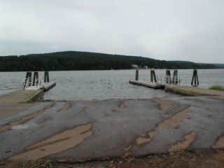
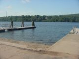
A view from the Salmon River boat launch.

Site Sketch of the Salmon River Boat Launch

Type: Trailered
Season: Year-round
Address: 117 E Haddam Moodus Road, East Haddam
Directions: Located at the mouth of Salmon River off Route 149, 1.5 miles north of the junction with Route 82.
Regulations:

(A) A 25 MPH nighttime speed limit from 1/2 hour after sunset until 1/2 hour before sunrise on all days of the year.
(B) A 30 MPH limit from 1/2 hour before sunrise to 1/2 hour after sunset on Saturdays and Sundays from the Saturday preceding Memorial Day to the Sunday preceding Labor Day inclusive and on Memorial Day, Independence Day and Labor Day.
(C) A 45 MPH limit, from 1/2 hour before sunrise to 1/2 hour after sunset, Monday through Friday, inclusive, during all seasons, and on Saturdays and Sundays from the Saturday following Labor Day to the Friday preceding Memorial Day.

No person shall operate a motorboat in excess of Slow-No-Wake: (A) From the Bulkeley Bridge in Hartford to Saybrook outer light in Old Saybrook; when passing marinas, yacht clubs, anchorages and docks, boat launches and congested areas. (B) Within the following specific areas: (1) The area between the Saybrook breakwaters bounded northerly by the Saybrook inner light and bounded southerly by the Saybrook outer light in Old Saybrook: (2) The area bounded northerly by navigation aid Connecticut River light #15 and bounded southerly by the southern most point of Saybrook Point in Old Saybrook;

(3) The area bounded northerly by navigation aid Connecticut River RED NUN #20 and bounded southerly by the railroad bascule bridge in Old Saybrook;

(4) The area bounded northerly by a point 800 feet upstream from the East Haddam Bridge and bounded southerly by a point 1,500 feet downstream from the East Haddam Bridge;

(5) The area bounded northerly by a point five hundred feet downstream from the highway bridge in Middletown and bounded southerly by navigation aid Connecticut River light #87;

(6) The area bounded northerly by the navigation aid Connecticut River light #113 and bounded southerly by the water tower on property now or formerly known as the Connecticut Foundry in Rocky Hill.

Fishing Regulations: Freshwater Fishing Guide (ct.gov) / Saltwater Fishing Guide (ct.gov)
Docks: Floating Wood (Seasonal)
Toilets: Chemical (Seasonal)
Parking Spaces: 60
Parking Surface: Gravel
Access Road Surface: Paved
Ramp Surface: Concrete Slab
ADA Accessible: Yes
Additional Info:

Access can be flooded during the spring months.

Schedule of Marine Events and Fishing Tournaments (ct.gov), (Note: tournaments are not open to the general public)

Select an image for larger view

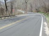
The entrance to the Salmon River boat launch.
Entrance

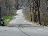
The access road to the Salmon River boat launch.
Access Road

The turning area of the Salmon River boat launch.
Turning Area

The ramp of the Salmon River boat launch.
Ramp

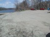
The parking area for the Salmon River boat launch.
Parking

Boat Launches in Connecticut

Content Last Updated on January 10, 2024