Fort McMurray, Alberta, Wildfire Exceptional Event Request
for May 25-26, 2016 Connecticut Ozone Monitor Data
for May 25-26, 2016 Connecticut Ozone Monitor Data
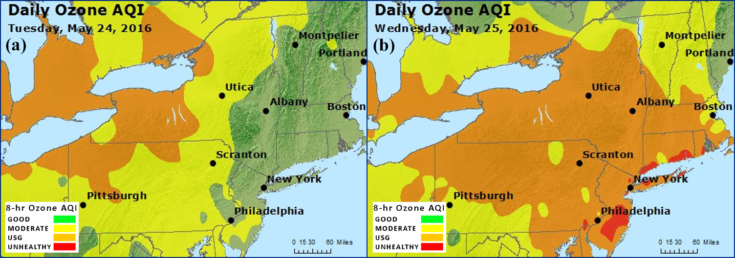
On May 25, 2016, An unusual area of elevated ozone concentrations over the upper Midwest and New York State moved into New England. This was unusual this early in the season and with the meteorological conditions present. It became apparent that the elevated ozone was likely due to the persistent Fort McMurray wildfire smoke plume that had been moving toward New England for several days. Therefore, in accordance with 40CFR 50.14, CT DEEP has flagged its ozone monitoring data for the period lasting from May 25, 2016 through May 28, 2016 for treatment as influenced by an exceptional event.
CT DEEP announced a 'Notice of Intent to Submit an Exceptional Event Demonstration to EPA and Opportunity for Public Comment' on April 18, 2017, which lasted through May 1, 2017. No comments were received except for a letter from EPA Region 1 stating that they had no further comments at this time. On May 23, 2017 the final version of the Exceptional Event Demonstration was electronically sent to EPA Region 1 for their review. On July 31, 2017, CT DEEP received a letter of concurrence from EPA Region 1 approving our Exceptional Event Demonstration.

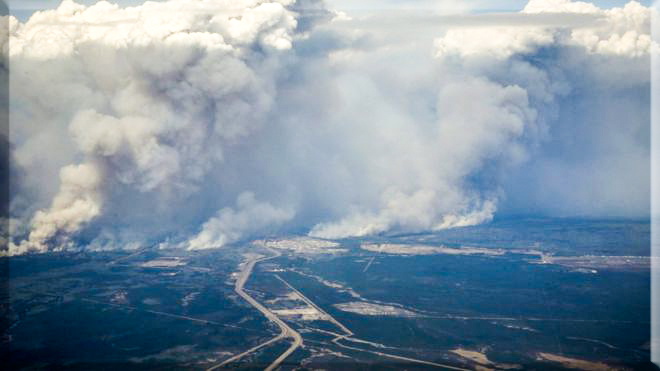
Image of the wildfire as it approaches Fort McMurray Alberta in early May, 2016

Images of Air Quality Index (AQI) maps showing unhealthy levels of ozone on May 24(a) and May 25, 2016(b) as the area moved to the east coast.
Supplemental Materials
Last Updated on August 1, 2017

