Connecticut State Forests Seedling Letterbox Series - Clues for Paugussett State Forest
|
|
Paugussett State Forest -
|
 |
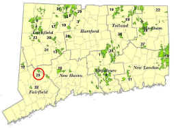
Paugussett State Forest is approximately 2,000 acres and is located in Newtown. It consists of two main areas, the Upper and Lower Blocks. The Upper Block is roughly 800 acres and was acquired in 1969 by the State through eminent domain for $1,100,000. The Lower Block is about 1,200 acres and has been acquired in phases since the 1940s.
The Forest is managed for sawtimber, firewood, wildlife habitat, and recreational activities such as hiking, hunting, bird-watching, and cross-country skiing.
Description: The letterbox is in the Upper Block of the Forest. Estimated time for round trip is 30 minutes.
Clues: The parking area for the Upper Block is at the end of Echo Valley Road in Newtown. Echo Valley Road is a dirt road that dead-ends in the Forest. You will see a brown State DEEP sign at the intersection of Sanford Road and Echo Valley Road that directs you to the parking area.
From the parking area, walk down the gravel woods road past the green gate. This road is called Brody Road, named after Polly Brody, a former member of the Newtown Conservation Commission. Ms. Brody was influential in convincing the State to acquire this property. Follow Brody Road for about 1,000 feet to where a dirt road forks off to the right. Take the right fork for about 750 feet. If you go too far, you will reach the intersection of the Blue Trail on the right; if so, just backtrack about 100 feet.
At this point, on the left side of the road, there is an opening in the stone wall. Enter through the opening. You will see a stand of tall, straight trees about 10" in diameter. These trees are younger than the surrounding forest because this area was clearcut in 1984. After the timber harvest, seed from nearby tulip poplar trees germinated in the increased sunlight that reached the forest floor, now we have a younger grove of healthy tulip poplars.
Shortly after the clearcut, the nuts of black walnuts were also planted in the opening. Very few of these survived, but there are two walnuts that are growing well and competing with the fast growing poplars. Can you find them? (Hint: the bark of the walnuts is much rougher than the smooth-barked poplars).
The letterbox is located under a rock at the base of one of the two walnuts, about 50' north of the stone wall.
Learn More, Earn Patch: Your walk has taken you to an area that reflects the renewable nature of our forests in Connecticut. Under good stewardship, our woodlands can be productive for generations to come.
This is one of 32 letterbox hikes that is being sponsored by the Connecticut Department of Energy and Environmental Protection’s Division of Forestry. When you have completed 5 of these sponsored letterbox hikes, you are eligible to earn a commemorative State Forest letterbox patch.
When you have completed five of these hikes, please contact us and let us know what sites you have visited, what your stamp looks like and how we may send you your patch. We will verify your visits and send the patch along to you. Contact DEEP Forestry
Content last updated September 10, 2021.


