
Letterboxing Clues for Nipmuck State Forest
Connecticut State Forests - Seedling Letterbox Series - Clues for Nipmuck State Forest |
||
|---|---|---|
|
Nipmuck State Forest - |
 |
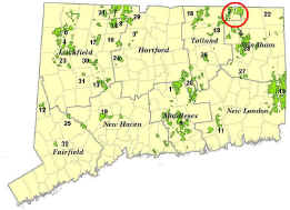
Nipmuck State Forest contains over 9,200 acres in the towns of Union, Stafford, Ashford, Willington, and Woodstock. The Snow Hill, Hedgehog Hill and Stickney Hill Blocks are located west of Interstate Route 84; the Breakneck Block is east of the highway.
The first tract of what was originally the Union State Forest was purchased for $3.57 an acre in 1905. State Forester Austin Hawes wanted the second State Forest to be in the pine type, as Connecticut had to import most of its softwood lumber. Eastern white pine competes successfully with hardwoods in this area, and eastern hemlock is also abundant. After land was acquired in other towns the forest was renamed Nipmuck State Forest in honor of the Nipmuck Indians.
The Nipmuck (or Nipmuc, meaning “Fresh Water People”) lived in encampments or villages near bodies of fresh water. These first Americans practiced vegetation management by cutting firewood, creating and abandoning agricultural clearings, and through the use of fire for various purposes. These practices, along with natural processes such as severe weather events, maintained a mosaic of vegetation types and ages, which helped sustain abundant wildlife food sources for the Nipmuck people.
The description of the vegetation in the Nipmuck’s Hatchet Lake Reservation in Woodstock as it was prior to being abandoned in 1831 probably is an accurate portrayal of most of the area before European colonization:
“The vegetation… was characterized by an open forest of oak, chestnut, and hickory on the slopes; white pine and hemlock in the swamps; and bushy plains of blueberry barrens on the overly drained acid-soil plateaus and hilltops. In other words, the uplands were essentially a subclimax maintained by the conflagrations set by the Indians… in fact, the whole ecology of the Indian occupied country was primarily a symbiotic relationship among the plant associations, the Indian, and his game animals.” (Bromley, S.W. 1945. An Indian Relic Area. Sci. Monthly 60: 153-54)
As European settlement intensified, in the 18th and 19th centuries much of the area was cleared for farming. Stonewalls built by early settlers are found throughout the Nipmuck State Forest, along with old roads and foundations. In the second half of the 1800’s, on the heels of large-scale agricultural abandonment, the fields and pastures reverted to forest, much of it white pine. Large volumes of this pine were later cut for boxwood and lumber. Around 1900, as many as twelve water-powered sawmills were in operation in Union.
In 1933 the Civilian Conservation Corps Camp Graves was set up in Union on what is now private land (Whipple Lane, on the north side of Route 190, near I-84). The CCC established softwood plantations, built forest roads, fire ponds and recreation areas, did timber stand improvement work and built CCC Camp Connor in Shenipsit State Forest in West Stafford. Camp Graves closed in 1936 when Camp Connor opened.
The hurricane of 1938 brought extensive change to the forest. This devastating storm demolished many sawtimber-size stands, especially white pine, with strong winds from a southeast direction. Included among them were many large white pine plantations. Stands that are now small sawtimber-size were established by natural regeneration on blown-over areas after the hurricane.
As a result of the hurricane, some of these forest stands are now two-aged, with the older trees being over 100 years old and dating back to the period of agricultural abandonment and subsequent harvesting activities, and others about 65 years old. The forest today has a good diversity of softwood (conifer) and hardwood (deciduous) species. It is managed by the Division of Forestry to maintain this diversity, as well as to provide forest interior wildlife habitat and to make the forest less susceptible to complete devastation from hurricanes. This last goal is achieved in part by having a good distribution of age-classes, as older trees are more likely to be broken or blown over in hurricanes than younger trees.
Description: The letterbox lies in a ravine along the Mashapaug Pond View Trail, west of Bigelow Hollow State Park in Union, in the Breakneck Block of Nipmuck. This trail is maintained by the Connecticut Forest and Park Association. The hike to the letterbox is about one mile, so the round trip is about two miles, but you can do loop hikes of either 3.5 or 5.5 miles if you so desire.
If you want to do the 5.5-mile loop, you have the option of starting at the trailhead at the north end of Bigelow Pond in Bigelow Hollow State Park. Even if you decide to do one of the shorter hikes, if you are unfamiliar with the area, it would be a good idea to drive to the trailhead in the Park first. There, you can look at the trail system map posted on the bulletin board. It tends to get dark rather early in Bigelow Hollow, so plan on finishing your hike well before sunset. Wearing bright orange during deer firearm hunting season (November and December) is strongly encouraged.
Clues: The starting point is on the north side of State Route 171 (Bigelow Hollow Road) in Union, 0.4 mile west of the entrance to Bigelow Hollow State Park. Find a large hemlock with double yellow-painted rings and State Forest Boundary tags, at a gravel forest road with a yellow gate. Park off the pavement, not blocking the gate. Nipmuck State Forest is west of the gravel road, Bigelow Hollow State Park is to the east. (South of Route 171 is the 7,840-acre Yale-Meyers Forest, owned and managed by Yale University.)
Walk north on the gravel road. The first 0.15 miles will be uphill. A few hundred feet after you start downhill will be the Mashapaug Pond View Trail. The trail is marked with blue blazes with a white bar on the bottom. It is easy to miss if you aren’t looking carefully. Turn left (west) onto the trail at a 16” dbh (diameter at breast height – 4.5’ above the ground) black oak.
You are walking through a pine/hemlock/hardwood forest stand, which had a first phase shelterwood harvest in the early 1990’s. The harvest created small to medium size openings. In these openings pine seedlings germinated from a good white pine cone crop. White pine cones take two years to develop, with a bumper crop of cones occurring sporadically, usually once every 3 to 5 years. These seedlings and saplings should continue to grow well in the partial shade conditions in these openings.
The trail heads northwest for about 600 feet, then swings to the southwest. Shortly after the turn to the southwest you’ll cross an intermittent stream. You will find this stream about 30’ after you have passed a large leaning tulip tree on the right side of the trail. About 1,000’ after the intermittent stream you’ll cross a larger stream and the trail will turn north/northeast. About 1,800’ after this turn the trail starts to run along the east side of a fairly steep ravine.
There are two very large rocks next to each other near the bottom of the ravine, and 100’ further north one very large rock right in the bottom of the ravine. About 100’ after you pass the single large rock, you’ll pass a blazed 22” dbh hemlock on the left side of the trail. About 100’ after the hemlock is a 12” dbh white pine. Get off the trail at this point and walk down into the bottom of the ravine past a 22” dbh sugar maple. A short distance to the north in the bottom of the ravine is a rock about 5’ by 4’ and about 2’ tall, with a fissure in the middle. Look into the fissure on the north side of the rock to find the letterbox.
Your options at this point are to retrace your steps, hike the entire 5.5 mile Mashapaug Pond View Trail, or do the 3.5 mile loop. You can do the shorter loop by continuing north on the trail to the pond and along the shoreline. You will come to a white-blazed trail that heads southeast a couple hundred feet to the gravel forest road you started on. Head south on this road 1.3 miles back to Route 171.
If you wish to continue hiking north on the trail from the letterbox, walking north a couple hundred feet in the bottom of the ravine will bring you back onto the trail. Most snags (standing dead trees) that would have posed a risk of falling on the trail have recently been cut down on that part of the trail between the letterbox and Route 171. However, there are several snags along the rest of the trail, so if you keep walking north on the trail, keep aware of dead trees that could pose a risk.
Learn More, Earn a Patch: Your hike has led you through a part of Nipmuck State Forest that was purchased in 1944 from the Quinnebaug Forestry Company. A total of over 4,500 acres of land was purchased from the Quinnebaug Forestry Company for the Nipmuck State Forest. Bigelow Hollow State Park, which previously was part of Nipmuck, was designated a State Park area in 1948. The Wells family started the Quinebaug Forestry Company to buy up woodlots and abandoned farmland to manage as forestland. The company operated a sawmill in Sturbridge, Massachusetts, and later created Old Sturbridge Village.
This is one of 32 letterbox hikes sponsored by the Connecticut Department of Environmental Protection’s Division of Forestry. When you have completed five of these sponsored letterbox hikes, you are eligible to earn a commemorative State Forest Centennial patch.
When you have completed five of these hikes, please contact us and let us know what sites you have visited, what your stamp looks like and how we may send you your patch. We will verify your visits and send the patch along to you. Contact DEEP Forestry
Content last reviewed February 2020