Connecticut State Forests - Seedling Letterbox Series Clues for Naugatuck State Forest

|
Naugatuck State Forest - |
 |
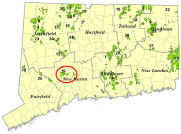
Naugatuck State Forest covers almost 5,000 acres and is spread across Naugatuck, Beacon Falls, Oxford, Bethany, Hamden, Cheshire, Ansonia, and Seymour. It is organized into five Blocks, named West, East, Mt. Sanford, Quillinan Reservoir, and Great Hill.
The Forest originated with Harris Whittemore, an industrialist and member of the State Forest and Park Commission. In 1921, Mr. Whittemore began buying parcels of land in the Naugatuck Valley, intending to donate them to the State. Unfortunately, he did not live long enough to realize his dream, but after his death in 1928, his family continued to acquire land, and in 1931, almost 2,000 acres were donated in his memory.
The Forest is managed for sawtimber, firewood, wildlife habitat, and recreational activities such as hiking, hunting, mountain biking, bird-watching, snowmobiling, and cross-country skiing.
Bird Checklist for Naugatuck State Forest
Description: The letterbox is in the West Block of Naugatuck State Forest. The starting point is at the end of Hunter Mountain Road in Naugatuck. The hike is a short walk from the parking area. Estimated time for a round trip is 20 minutes.
Clues: From Route 8 in Naugatuck, take exit 26 (Route 63). Go west across the bridge over the Naugatuck River. After you cross the river, turn left at the first light (Cherry St. Ext.). Go 0.6 miles to a stop sign. Turn right on Spencer St. Go 0.3 miles, to a stop sign. Turn left on Lewis St. Go up a steep hill (becomes Hunter Mountain Rd. although there are no street signs) and continue for 1.2 miles. You will come to an intersection with a state forest road on the left. There will be a log house on the right (private residence). Continue straight up the hill for 0.4 miles to the end of the paved road where you can park. On the left will be a green gate. (Please – don’t park in front of the gate!).
Starting at the gate, walk 0.2 miles along the road (you will be heading south) until you see a pair of old wooden posts, one on either side of the road.
Starting at the post on your right (west side of the road), proceed 95 feet at a compass bearing (based on true north) of S 20° W (or 200°) to a low, flat rock. As you walk along, you will see trees with red numbers on the trunks. At the boulder, tree # 37 (a red oak) will be on your left. If you don’t have a compass, you should still be able to find the rock if you just keep looking for those numbered trees
Look under the rock for the letterbox.
The area in which the letterbox is located was originally planted with red pines by Harris Whittemore’s forester, William Shepardson, before state ownership. Unbeknownst to the two men, in 1938, an insect, called the red pine scale, would be accidentally imported to this country on plantings at the World’s Fair in New York City.
Unfortunately, the red pine scale is lethal to red pines, and by the 1970s, it had spread to Naugatuck and was killing this plantation. The DEEP salvaged the trees for lumber, and instead of replanting, allowed the native forest to regrow.
Because most of Connecticut’s forests are at least 80 years old, having a relatively young forest of oaks provided a unique opportunity for Research Foresters at the Connecticut Agricultural Experiment Station to study how young oak trees grow in competition with other trees. Periodically, trees adjacent to the oaks are removed and the changes in growth of the remaining trees are measured. Please don’t disturb any trees in the study area.
Learn more, earn a patch: This is one of 32 letterbox hikes that will be sponsored by the Connecticut Department of Energy and Environmental Protection’s Division of Forestry. When you have completed 5 of these sponsored letterbox hikes, you are eligible to earn a commemorative State Forest letterbox patch.
When you have completed five of these hikes, please contact us and let us know what sites you have visited, what your stamp looks like and how we may send you your patch. We will verify your visits and send the patch along to you. Contact DEEP Forestry
Content last reviewed September 10, 2021

