
Letterboxing Clues for Nassahegon State Forest
Connecticut State Forests - Seedling Letterbox Series Clues for Nassahegon State Forest
| State Map | State Forest | Letter Box Stamp |
|---|---|---|
|
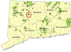
Nassahegon State Forest -
|
 |
Nassahegon State Forest, located entirely in the town of Burlington, is approximately 1,352 acres. This forest was originally designated in 1926 to protect the watershed for the state fish hatchery, now called the Burlington Trout Hatchery. Nassahegon State Forest was considered part of Nepaug State Forest until 1942. Today the forest is actively managed for forest products, wildlife habitat, and a variety of recreational activities including hunting, hiking, mountain biking and birdwatching. Nassahegon is home to miles of Blue-blazed hiking trails and white-blazed bike trails, and helps give Burlington its rural character, as well as provide a protective buffer for DEEP's State Fish Hatchery, a true area landmark.
The hatchery provides fishing stock for closet to 360 different water bodies, including everything west of the Connecticut River, as well as the other fish hatchery in eastern Connecticut. It produces hundreds of thousands of fish annually - in the most recent season, the Burlington hatchery yielded approximately 200,000 adult fish, 400,000 fry, and 29,000 fingerlings, totaling over 100,000 pounds!! Brown trout, brook trout, rainbow trout, tiger trout, and Kokanee salmon are all reared at the facility. The hatchery was established in 1925, and 80 years later, it is still serving the state. It runs on a gravity water system, which means there are no electrical costs for water pumping.
Description: The letterbox lies close to a Blue-blazed Trail off Punch Brook Road, across from the Burlington ball fields (known as the Nassahegon Recreation Complex). This hike will take you into the woods for about 2,125 feet—round trip distance of walk is 4,250 feet or about four-fifths of a mile. Winter may restrict parking, as there may be little room to park off Punch Brook Road. Also note that it can be dangerous pulling back onto Punch Brook Road when leaving, due to limited sightlines and vehicles speeding as they approach the area, especially from the east. If parking in the town recreation area lot, be careful walking across the street to the state forest. Bright orange clothing is recommended Sept.-Dec. for hunting season. Ticks are common here most of the year, and you should check your clothing frequently. Look closely, the ticks can be very tiny, and light-colored clothing is recommended!
Finally, note that it is NOT essential to have a compass to find your objective, but it may prove helpful.
CLUES: At the junction of Route 4 and Route 69 in the center of Burlington (by a Cumberland Farms), go East on Route 4 for several hundred yards and take a right at the “Y” onto George Washington Turnpike. Pass the fire station and post office on your right, and continue past Cornwall Road and Belden Road. Keep going and bear all the way to the left (sharp uphill curve) at the splitting of roads. The road is now Punch Brook Road. You will see the town ball fields on the right, known as the Nassahegon Recreation Complex. Park off the road on the left, where you see a wide area barricaded by a gate made of tree poles. There is also a small wooden roofed map kiosk on one side. Park on the wood chips in front of “gate”.
Walk past the gate and immediately take the more narrow trail off to your left. This trail parallels Punch Brook Road as you follow it to the west. Go about 500 feet. As you proceed, look at the younger forest on your right, made up mostly of oak and white pine. This area was a clearcut approximately 35-40 years ago. It was a red pine plantation that was being attacked and killed by an insect. After the red pine was removed, native forest returned naturally in its place. Objectives of the DEEP Forestry Division include providing younger age classes of forest throughout our state for diversity of wildlife habitat, and so that the forest is healthier and diverse enough to withstand natural disasters such as hurricane, insects and disease. If we have a forest that provides a variety of ages, species of trees, and cover types, such disasters are less likely to have widespread and devastating impacts on Connecticut’s forests and wildlife populations. But it takes long term planning to achieve this, and active forest management over many years. The area you are visiting today has been actively managed for decades and is a “working forest”. The trails upon which you will be walking are actually “skid roads” created to access the woods for timber harvesting and other forestry activities.
At the large opening ahead, bear sharp right on the trail and head north, for 350’. The opening along the trail was actually a pitch pine regeneration cut. The scattered remaining pine trees you see with the very rough bark are pitch pines. Pitch pine has been gradually vanishing from our state due to development and lack of disturbance in forests. The pitch pine sand plain is considered the most imperiled ecosystem in Connecticut, and has a dozen state-listed species associated with it. To encourage new pitch pine seedlings, a lot of full sunlight is needed, so most trees must be cut. It also helps if there is soil scarification, or a fire. In this case, there was just a logging operation during a pine cone crop, and the work helped plant the seed for development of new seedlings.
After the 350’, there will be a fork—take the left pathway, which is more narrow, and continue northerly. Proceed for 600’ on this trail. You may see some pink and black striped flagging tape along this trail, so that you know you’re in the right place. Do you know any of the plants and types of tree seedlings growing close to you along this trail?
You will soon connect with the Blue/White Trail (or the “White Dot Trail”), and turn right. Note that you will not see Blue Blazes on your right immediately, you will more easily see blazes to your left and behind you. Go for approximately 300’, and you will see a red pine with a double blue blaze. This is the type of pine that was mostly killed and salvaged between the 1970s and 1990s. A few scattered trees remain today. Look closely, do you see why it may be called red pine? Notice the reddish coloration of its bark? How does it differ from the bark of the much rougher and darker pitch pines?
If you have time, look around and see if you can tell the difference between the pine seedlings and distinguish between pine cones on the ground. White pine has soft needles in groupings (or fascicles) of 5. Pitch pine has rigid, pointy needles in 3’s, and red in 2’s. White pine cones are long and skinny. Pitch pine cones are rounded with sharp spines. Red pine cones are smaller and rounded but with NO sharp spines.
At the red pine with the double directional blue blazes, follow the Blue Trail and turn left. You only have about 375’ to go! Stay on the Blue/White Trail until you see a brown metal “Forest Thinning” sign on the left. This sign has been in place approximately 20 years! What do you think, does the area need another thinning? Can you tell that anything was cut there once?
Your goal is a short distance behind the sign. Look carefully on the back side of a small pile of woody debris about 20 feet away. When done, be sure and properly conceal and bag it up well, to protect the box from the rain.
Before leaving, you might look around at younger white pine you see. Remember, white pine has needles in 5’s and the needles feel soft to the touch. Age of a white pine can be easily determined by counting the “whorls” of branches. Branches grow along the main stem of a white pine only in whorls that occur in a circle around the stem. The space between these sets of whorls represent one year’s growth! Can you tell the age of some younger pine saplings?
Learn More, Earn a Patch: Your walk has led you through a working forest. Although there may seem to be no relation at first glance, a healthy forest creates a great buffer and "filter" for improved water quality downstream - in this case, for Belden Brook and Punch Brook, and its tributaries and associated springs, which supply water for the state fish hatchery.
The hatchery is open to the public from 8:00 am to 3:30 pm daily for self-guided tours. For more information on the hatchery and its fish, call 860-673-2340 or visit the Burlington State Fish Hatchery webpage.
This is one of 32 letterbox hikes in the new, second series of boxes, called the “Seedling Series”, sponsored by the Connecticut Department of Energy and Environmental Protection’s Division of Forestry. Take 4 additional sponsored letterbox hikes to earn a commemorative Connecticut Forestry Centennial patch.
When you have completed the five hikes, please contact us and let us know what sites you have visited, what your stamp looks like and how we may send you your patch. We will verify your visits and send the patch along to you. Contact DEEP Forestry
Content last updated on September 10, 2021