
Letterboxing Clues for Mattatuck State Forest
Connecticut State Forests - Seedling Letterbox Series Clues for Mattatuck State Forest
| Location Map | State Forest Information | Letterbox Stamp |
|---|---|---|
|
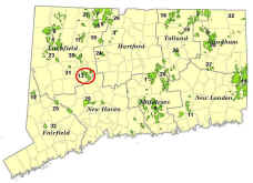
Mattatuck State Forest -
|
|
Mattatuck State Forest covers over 4,000 acres in the towns of Waterbury, Plymouth, Thomaston, Watertown, Litchfield, and Harwinton and is an important part of the scenic drive along the Naugatuck River. The land on which Mattatuck is located was acquired starting in 1926. This happened through a mix of land donations by the Black Rock Association and purchases by the state. Today’s forest hides evidence of the region’s rugged past, including quarries, lime kilns, house foundations, agricultural fields, and charcoal mounds. Signs of the region’s history of industry and resource exploitation abound. Our modern maturing forest composition and structure are a product of repeated clearcutting and forest fire activity from centuries past, as well as from more recent fires. This is an ironic truth about Connecticut forests—that many of the most treasured and scenic locales are a product of disturbance on a grand scale. It is also a sure sign of nature’s resilience and of the determination of resource managers and conservationists.
Today, Mattatuck is managed responsibly and scientifically for forest products and wildlife habitat, as well as for recreational activities such as hiking and hunting. There are miles of rugged trails with scenic overlooks in convenient proximity to the city of Waterbury and surrounding towns. The forested corridor of Mattatuck provides a transition from the more industrial/urban landscape of the Naugatuck Valley to the “quieter” countryside of the Litchfield Hills.
Description: The feature of focus on the way to this letterbox is certainly one of the more interesting natural landmarks at Mattatuck and one of historical significance - the Leather Man's Cave. There are two options for reaching the Leather Man's Cave, described in detail in your clues. Both options are over 3,000 feet (more than a half-mile), one way.
General Cautions—All options involve some degree of hiking on steep terrain and on exposed rock ledge, which can be very slippery in wet conditions. Please, choose your steps carefully! Read the clues very carefully and keep track of where you are going.
Both Options 1 and 2 begin with old forest roadbeds that are not Blue-blazed Trails. You will need to backtrack properly after letterboxing to reach your car! The easiest way to ensure you get out without being lost is to make careful note of any turns and forks along the way. Note which way you came from at the intersections, especially where your path first intersected with the Blue Trail. Also, be wary of traffic if parking on Route 6, as that road can be very busy.
Parking for either Option 1 or 2 may be difficult to impossible in winter, depending upon snow conditions. You are also advised that portions of either option can be dangerous in winter, especially in areas of steep terrain or rock ledge when snow and ice are present. Use extreme caution if planning to visit in winter. In fall hunting season (October-December), be sure to wear blaze orange. It is suggested, but not imperative, that you bring a compass.
It is also suggested that you do not wear sandal-type footwear while taking this hike, due to the woody debris you will have to step through at the beginning of the walk under either of the options below. This debris is not difficult to get through, but it would be uncomfortable for someone wearing open footwear.
If you are claustrophobic, the Leather Man’s Cave could be difficult for you.The Blue-blazed trail follows the "cave" for its entire length, which is only 40-50 feet but includes tight squeezes in low light. (The "cave" is actually formed from chance placement of overhangs and past ledge collapses and it is not to be confused with limestone caverns.) A small flashlight may come in handy if overcast or nearing sunset. It may make your brief spelunking safer and assist you in finding the letterbox. If you need them, there are dirt paths that skirt around the "cave" and bring you back to the Blue-blazed trail.
Clues: OPTION 1— Hike = 3,400 feet, one-way (not including short overlook detour).
This hike is not the absolute shortest, but is considered the easier of the two options.
In Thomaston, get on Route 6 West (exit 38 off Route 8). You will pass a Smokey Bear fire danger sign on your right (just past the junction with Route 109), followed by the entrance to Black Rock State Park. From the Black Rock main entrance, go 1.1 miles and take a left onto Park Road, a paved road.
If coming from the West, through the Watertown area, Park Road is 2.4 miles from the intersection of Route 6 and 63.
Go a total of 0.3 miles up the sharply winding road—you will see a “Deaf Child Area” sign, followed by two mailboxes on the left, numbered 873 and 874. Turn left immediately after those mailboxes and go between two houses (this is exactly opposite a driveway marked by two short stone pillars). The road will look like someone’s private driveway at first!
Go straight ahead, ignoring driveways, sort of bearing off to the right. The road turns to dirt just to the left of a very large tree stump. You might notice yellow paint and "State Land" signs on the left side of the raod here that mark the State Forest Boundary. Follow that road for less than 1/10-mile and park in the small turnaround on the left just before the green gate. Do not block gate.
Walk past the gate and follow the old roadbed gradually downhill (caution – do not take the trail right of the gate that goes sharply downhill). This is the old Jericho Road. Hike down this roadway for 1,000 feet (or about 400 adult-size steps!). (At a turn in old road, there is a small spur trail that goes off to the left, stay to the right on the old roadbed.) Along the way note that most of the surrounding forest is very young compared to the majority of Connecticut’s forests. In 1986, a 300-acre forest fire killed most of the trees in this area. Afterward, DEEP harvested and salvaged the wood from these trees. The younger forest you see today regenerated naturally, without trees being planting.
After the estimated 1,000 feet, you’ll come to a junction with a Blue-blazed Trail. This is the Jericho Trail. Turn left, heading northeasterly on the trail (do not stay on main roadbed, which heads downhill). Carefully note this location, as you must return this way later!
Go an estimated 1,675 feet (670 steps) northward on this Blue Trail, being careful to stay on the blue blazes (shortly after you enter the trail, there will be a fork; follow the more worn path left and eventually you’ll see the blazes again). Along the way, you will see a ledge overhang on the left—this is not your cave, but is an interesting formation and typical of this “Cave Block” of Mattatuck, which has numerous ledge faces and small, intricate caves and passages.
At the end of the above distance, you should be at a trail junction and a wooden trail sign. You are at a point where Jericho Trail terminates at the Mattatuck Trail mainline. You will be turning right and following the trail in front of the rock ledge.
See “Everyone” below.
OPTION 2—Hike = 3,150 feet, one-way (not including short overlook route)
Note: This hike is more of a challenge to find your way back after locating letterbox! Watch your route carefully and don’t get lost on your return hike!
In Thomaston, get on Route 6 West (exit 38 off Route 8). You will pass a Smokey Bear fire danger on your right (just past the junction with Route 109), followed by the entrance to Black Rock State Park. From the Black Rock main entrance, go 0.65 miles (0.8 miles from Smokey Bear) and pull off Route 6 on the left or east side of the road, onto the dirt road that “Y”s off of Route 6 and heads uphill.
If coming from the West, through the Watertown area, this location is 2.9 miles from the intersection of Route 6 and 63.
Park safely off of Route 6 near the beginning of this dirt road. Remember that Route 6 can be a very busy road, so be extra careful pulling in and out of this spot.
Go up this old road, past the boulder and dirt mound that blocks vehicle access, for 750 feet (or around 300 adult-size steps!). Note that this first stretch involves stepping over debris and branches that resulted from mechanically cutting back the road edges, so watch your footing and walk carefully.
You’ll come to a fork. Just go straight ahead, bearing left toward the East/Northeast.
Continue approximately 440 feet (176 steps) and you will come to a junction with a Blue-blazed Trail. This is the Mattatuck Trail, a 38-mile long trail that you can also see miles away at the Mohawk State Forest letterbox!
At this trail, go straight, staying on the old roadbed, ignoring the trail going uphill to your left. Go another 125 feet (50 steps) and you'll come to a “T”, with one trail going off to the left, and 3 trails forking just off to your right. Go right at the “T”, then bear all the way to the left immediately at the 3-way fork, staying on the Blue-blazed Trail. (The easiest way to avoid confusion in this area is to just remember to follow the blue blazes. Note that you will not see many blue blazes at first, but keep looking. You will also see some old yellow paint on a few trees.)
Go approximately 1,100 feet (440 steps). The Blue-trail makes a sharp left turn to a rocky overlook at about 1,000 feet but continue straight on the dirt path. Stop before the blue-painted trail sign, which marks the intersection between the Mattatuck and Jericho Trails.
See “Everyone” below.
Everyone — To the overlook - Facing the trail signs, head left, following the blue blazes onto the exposed ledge-top. You will go about 175 feet (70 steps) across the rocky overlook. This is “Crane’s Lookout”. From here, you can see the countryside about 270 degrees all around you. You are now standing above the Leather Man’s Cave.
Near the top of the ledge, look on the ledge-top just 25-30 feet West. You will see a shrub-like patch of oak, no taller than 5-6 feet above the ground. This is bear oak (also known as "scrub oak"). The only places this species can be seen in Connecticut are on ledge atop hills and mountains such as this. In summer you can note that the leathery leaves are smaller, with slighter lobes and sinuses (the dips along the edge of the leaf between the lobes) that the scarlet oak, black oak, and red oak in the area. It does not grow tall or straight, due to its habit of germinating and growing where there is barely any soil. The prevalence of strong winds also limits this plant's height in these exposed mountaintop areas. Return to the trail signs 175 feet away.
To the letterbox - Bear left, heading downhill to follow Mattatuck Trail, instead of Jericho Trail. YOU will go about 150 feet (60 steps) and see the cave entrance to your left. This is the Leather Man's Cave.
Carefully walk through the cave, which is approximately 50 feet long. (if needed, use the informal paths that skirt around the cave.)
The nearby rock shelter was one of the regular lodgings of the legendary “Leather Man”, who by most accounts spent more than 30 years from 1856 to 1889 as a “vagrant”, walking through the Connecticut and New York countryside, bouncing between the Hudson River and Connecticut River. After many years of tramping he settled into a clockwise loop, which totaled about 365 miles, averaging about 10 miles/day.
His schedule was so predictable (virtually always bringing him to the same point again every 34 days), that locals would watch for his return and many would have meals ready for him. He would politely accept food and had a hearty appetite, undoubtedly from his daily “workout”. The Leather Man did not work for his meals, would not accept shelter or money, but gladly took tobacco and leather scraps when offered. He rarely spoke and when he did it was in broken English.
One story of his origins was that he was Jules Bourglay of Lyons, France. Jules, it was written, abandoned his homeland after breaking his wallet in the failing leather trade . . . and along with it, his heart, to a young woman named Margaret Laron, the daughter of the leather merchant who employed him. Bourglay came to America, and simply began walking in solitude, clothed in the “substance of his ruin”, an all leather suit. This story was later proved to be false, but it continues to be retold to this day.
At one point, he was believed to be perhaps the most famous figure in Connecticut, walking continuously, year-round in his leather suit and shoes together that weighed 70 pounds! His curious popularity was so great that although the Connecticut General Assembly passed a “tramp law” in 1879, which permitted the arresting and jailing of hobos, there is no record he was ever arrested, except in 1888 in concern for his health.
The Leather Man was found dead (by some accounts from a head injury, by others from cancer for which he would not accept treatment) in one of his shelters in New York in March 1889 and has a marked grave in Sparta Cemetery near Ossining, NY. The rock shelter in Mattatuck Forest is one of a number of “Leather Man’s caves” on his route. There is a good chance that the Leather Man slept in this cave hundreds of times during the years of his predictable travels. Although dead now for well over a century, the romanticism and legend around this mysterious character has survived. There was even a Pearl Jam song about him in the 1990s!
Now to find your letterbox: Once you are through the cave and on the other side, your hike is not yet over! The letterbox is another 500 feet down Mattatuck Trail. There will be some hand-over-foot climbing on the way. Follow this trail downhill as you pass more interesting ledge formations and small caves. Eventually, the trail leaves the ledge and rock and becomes a narrow path through dense mountain laurel. Mountain laurel, sassafras and witch-hazel restocked the area following a fire in the 1980s. Note that the few larger trees that are left in the vicinity have old wounds at the base - these are fire scars.
Soon the trail will go up onto a large rock, signifying a return of the trail to rock ledge. From the first rock look right or due East.You should see a small fallen tree that has been rotting on the ground for many years. Look under a stone at the base of the common root mass for your letterbox, just a few feet off of the Blue-blazed Trail?
Be extra careful when getting off the trail to find this box, and don't get close to the drop-off just beyond the fallen tree. Also, keep in mind that you can basically see the hiding spot from the hiking trail, so you must do a good job of concealing the box when you are done so that it will not be happened upon by chance. This is very important! It might also help if you tread lightly and get the box without excess damage and breakage of vegetation on the way - a new path worn between Mattatuck Trail and the letterbox hiding place can also draw unwanted attention and lead to the disappearance of the letterbox.
For a longer and more rugged hike, you may park at the roadside parking provided on Route 6 next to the oval, blue “Mattatuck Trail” sign. You will see this sign a half-mile west of the Watertown/Thomaston town line, or about 0.4 miles west of the Black Rock State Park entrance. From there, get on the East side of the road (side of road opposite the Black Rock main entrance) and hike the Mattatuck Trail all the way to the cave. Total hike one-way on this option is 1 mile.
Learn More, Earn a Patch: DEEP hopes you enjoyed your visit to Mattatuck State Forest, which highlighted one of the more interesting landmarks of the area, as well as one of the more tragic and colorful characters in Connecticut history, the Leather Man.
This is one of 32 letterbox hikes in the new second series of boxes, called the “Seedling Series”, sponsored by the Connecticut Department of Energy and Environmental Protection’s Division of Forestry. This letterbox replaces the original series box off Bidwell Hill Road. Take 4 additional sponsored letterbox hikes to earn a commemorative Connecticut Forestry Centennial patch. When you have completed five of these hikes, please contact us and let us know what sites you have visited, what your stamp looks like and how we may send you your patch. We will verify your visits and send the patch along to you. Contact DEEP Forestry
Content last updated September 9, 2021