
Letterboxing Clues for Housatonic State Forest
Connecticut State Forests - Seedling Letterbox Series Clues for Housatonic State Forest
|
|
Housatonic State Forest - |

|
|---|
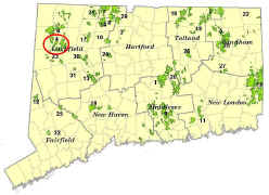
Housatonic State Forest consists of nearly 10,000 acres in 5 towns. It is the only Connecticut state forest containing part of the world-famous Appalachian Trail (AT). This trail runs for over 2,100 miles, from Georgia to Maine.
More than 3,000 acres of original purchases for the state forest were from one iron company in 1927. This gives a hint of the region’s land use history. Most of the picturesque hills that make up the topography of Housatonic State Forest were once repeatedly clearcut to feed the charcoal demands of the iron industry. Abundance of charcoal mounds across the landscape (round, flat-top mounds approximately 20 feet across) is evidence of this history. Today, the trees have re-grown, and the rugged hills of the state forest provide a panoramic backdrop for the scenic Housatonic River, producing what is arguably the most beautiful region of Connecticut.
Today, this land is a multiple-use state forest. Housatonic State Forest is managed for its diversity of native wildlife, high quality forest products, watershed protection for the Housatonic River, scientific research, a variety of recreational activities, and for the aesthetic beauty that is hard to beat anywhere else in the state. The state forest is also home to two different Connecticut Natural Area Preserves: Gold’s Pines and the Canaan Mountain Natural Area Preserve. Natural Area Preserves are established to highlight areas of special significance to our state’s natural history and to serve as refuges for rare species of plants or animals, and tend to feature noteworthy examples of natural ecosystems. Some of these Preserves require active management such as cutting or prescribed fire to maintain the unique and valuable characteristics that led to their designation.
Description: The letterbox lies in the Sharon Mountain Block of the Housatonic State Forest, within the town of Sharon. This letterbox is the only one located along the Appalachian Trail! The hike is approximately 4,000 feet, one way (3,550 feet is on a state forest road. The remaining few hundred feet is on and adjacent to the Appalachian Trail.). Roundtrip distance is 1-1/2 miles. Wear bright orange from October through December in hunting seasons. Timber rattlesnakes may occur in this area during summer, so be wary of where you step once off of the state forest road. Deer flies can bite fiercely in this area during mid- to late summer, and ticks are common most of the year, except when the ground is snow-covered. The gravel road beyond the parking area is a snowmobile trail in winter.
Please do not attempt to drive this rough road. Letterboxers should park in the public parking area and hike the road.
Clues: From points east in Connecticut, go to the junction of Routes 4, 128, and 43 at the Berkshire Country Store. From there, follow Route 128 West. Travel 3.8 miles on Route 128. You will cross a covered bridge in the village of West Cornwall. Bear right at the fork immediately after the covered bridge. You will get onto Route 7 North briefly, turning left immediately onto West Cornwall Road. Follow this road into the Sharon countryside for 3.4 miles. Shortly after a boulder which nearly juts into the roadway on the right, turn right. Follow this road 1/10-mile and park in the turnaround, which is a public parking area for snowmobilers.
Walk in on the old road past the snowmobile sign-in box. As you begin your hike, notice the red signs posted on the left, proclaiming that side of the road is a “Closed Area - No Trespassing (April 15-October 17)”. This is a wildlife research area. Please respect the signs and avoid disturbing the wildlife habitat in DEEP’s study.
Hike up the road for approximately 1,100 feet (a little under a quarter-mile). The landmark will be another road on the left blocked by a green gate. On your right is the “Brostic Hut”; a shelter used by the Appalachian Trail seasonal “Ridgerunners” and the Appalachian Mountain Club (AMC) Trails Committee. Ridgerunners patrol the nearby AT. They help educate hikers, pick up litter, obliterate illegal fire rings, report problems and do some light maintenance.
Continue up the main road another 2,450 feet (a little under a half-mile) to the point where the AT crosses the road. You will see the white-painted blazes on either side of the road, marking the trail, as well as a wooden backpacker sign. Take a left onto the trail and do what hundreds of “thru-hikers” do for 5-6 months of their lives annually: Follow the white blazes! You are now on the Appalachian Trail. Remember to watch your step for possible rattlesnakes in this area from about late spring through early fall.
Although this spot may look very quaint and discreet, just another hiking path perhaps, the AT is the most popular hiking destination in the country. More than 4 million people use some part of the AT annually, mostly for short hikes. Thousands set out to hike the entire trail, and only a few hundred or less may succeed. The trail runs over 2,100 continuous miles, from Springer Mountain in Georgia to Mt. Katahdin in northern Maine. It passes through 14 states, 8 national forests, 6 national parks, and many types of state and local public land. The entire length of the trail is set aside by an act of Congress and the National Park Service for foot traffic only. The AT was originally established in the 1930s, and its first successful “thru-hike” by a lone hiker was in 1948. Just a half-century later, today’s AT experience has grown into an outdoors icon. It is an adventure in endurance, self-exploration and personal achievement that has become a top life goal for many and a subculture in itself.
From the forest road, follow the trail northward. You will cross a small stream almost immediately. Follow the trail about 375 feet (150 adult-size steps). At this point, look directly left about 25 feet off of the AT. You should see a round, flat-top mound. Depending on the width of your steps, you may have to back up or continue forward just a little to find the mound.
From your experience with several other state forest letterboxes, you may know that this is a charcoal hearth. This type of landmark is certainly worth another look, considering how heavily the charcoal era was responsible for the composition of many of today’s Connecticut forests. Much of the Housatonic State Forest was once owned by the iron industry, and was clearcut numerous times to produce the charcoal needed in the production of iron during the nineteenth and very early twentieth centuries. Charcoal mounds like this one are found all over the countryside in Housatonic and other forests, some at a frequency of 2-3 per acre.
In making a charcoal mound like this one, about 30 cords of firewood (more than most active wood-burning homes will use in 3-4 years) was carefully stacked in a teepee fashion, covered and slowly burned for 10-15 days. In just a couple weeks, this mound may have produced 1,000 bushels of charcoal. The charcoal workers were called “colliers”. It was a dirty, rugged and painstaking job to build and maintain the charcoal hearths.
At the time, these hills were not covered in beautiful mature hardwood forest. For the most part, they were cleared of trees and choked with the smoke of many dozens of charcoal hearths. Today’s predominantly oak forest exists partly due to this seemingly destructive and polluting era. Oak is not tolerant to the shade of other trees, but it both re-sprouts and seeds in well following a clearcut. The widespread forest fires in Connecticut a century ago also promoted reproduction of oak, which handled the disturbance well. Fires repeatedly kept the more shade tolerant competing species under control.
Go take a walk across the charcoal mound. It is about 30 feet across. On the other side of the mound from the AT, look straight ahead—you’ll see triple red oaks, all connected at the stump, varying in diameter from about 8-10 inches. These trees are about 15 feet from the edge of the charcoal mound. Go to these trees and stand on the opposite side of them.
Now look directly ahead, and slightly to the left, while your back is against the red oak in the trio that is furthest from the charcoal mound. If you have a compass, you will want to shoot for approximately a bearing of N60W or an azimuth of 300.
Do you know the difference between a bearing and an azimuth reading? Bearings divide the compass into 4 quadrants: Northeast, Southeast, Southwest, and Northwest. In each quadrant, the bearing goes from 0 to 90 degrees, starting at either due north or due south, whichever is closest to your quadrant. Bearings are written with directions both before and after the number, as in N60W, which means “North 60 degrees West”. That indicates the quadrant. An azimuth does not repeat a number in degrees. It simply starts at due north and as you go clockwise, it builds all the way to 360 degrees. 360 degrees is the same as 0, your point of beginning. So every bearing has an equivalent azimuth. The terms are often not well understood by the general public, and are frequently used interchangeably.
Following either the compass bearing or the azimuth (if you happen to have a compass – one is not essential to find your destination), go 20 feet to the double chestnut oaks. If you are at the site in summer, note the difference between the red oak and chestnut oak leaves. Red oaks have more pronounced lobes and deep sinuses between the lobes of the leaves. Chestnut oaks lack defined lobes but have broad “teeth” along the edge of the leaves, vaguely similar to a chestnut leaf.
Look in the “bowl” formed between these two chestnut oak trees for your prize!
The total distance to the letterbox from the AT is about 95 feet. Note that this hiding spot can collect rainwater, so be sure to keep the letterbox securely bagged. Also, help us by covering it a little with leaves to hide it from someone who might accidentally stumble across it.
Learn More, Earn a Patch: Your walk has led you through a different part of this large state forest than you saw in following the clues for the original Centennial Series letterbox. In that case, you went through the Golds Pines Natural Area Preserve. Interesting difference, don’t you think?
You are encouraged to visit Housatonic State Forest again and explore the miles of Appalachian Trail that passes through this forest and other areas in scenic northwest Connecticut. This is one of 32 letterbox treks in the second series of boxes, called the “Seedling Series” sponsored by the Connecticut Department of Energy and Environmental Protection’s Division of Forestry. Take 4 additional sponsored letterbox hikes to earn a commemorative Connecticut Forestry Centennial patch. When you have completed five of these hikes, please contact us and let us know what sites you have visited, what your stamp looks like, and how we may send your patch. We will verify your visits and send the patch along to you. Contact DEEP Forestry
Content last updated October 2015