Staffordville Reservoir, Stafford Springs - 2019
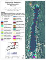
2019 Aquatic Plant Survey Map of Staffordville Reservoir
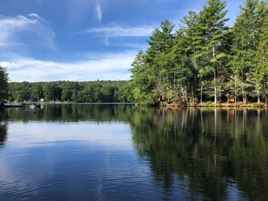
Staffordville Reservoir is a 149-acre waterbody located in Stafford Springs, CT. The south and east shorelines are more heavily developed than the north and west shorelines where it is thickly wooded. A public beach is located at the southern end of the lake.
The 2019 aquatic plant survey was the third survey of the reservoir conducted by CAES IAPP; the first in 2005 and the second in 2012. This survey revealed similar conditions to 2012. The northern cove is the most densely populated section of the lake, completely covered by native lilies with bladderwort species (Utricularia sp.) mixed in below. The eastern and western shorelines remained largely unchanged, with eelgrass (Vallisneria americana) found along much of the eastern shoreline. The southern end of the lake had abundant and diverse aquatic vegetation, though not to the surface as much as the north cove.
The biggest change is no Brazilian waterweed (Egeria densa) nor was any other invasive species found in the lake. Overall, Staffordville Reservoir is continuing to support a large amount of aquatic vegetation with 29 native species and no invasive species. The most abundant species was eel grass; however it does not seem to impede boat use. Aside from the north cove, the lake was easily navigable, although presence of eel grass around docks and in swimming areas may impede swimming.
Staffordville Reservoir 2020 Report


