
Connecticut Healthy Waters Initiative
Connecticut's Healthy Waters Initiative
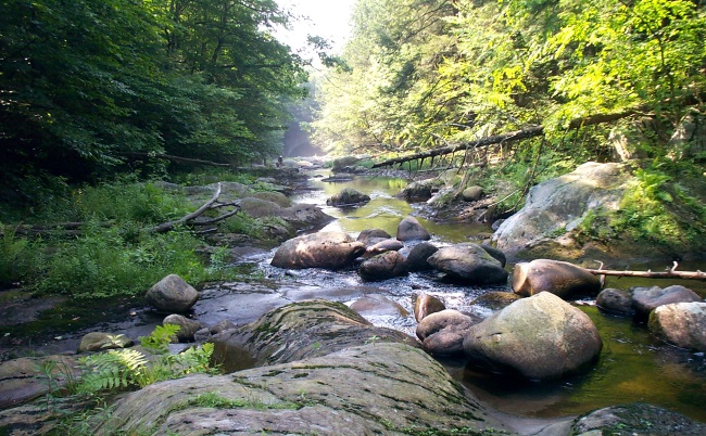
For several decades, the DEEP Monitoring Group has been building multidisciplinary datasets that include water chemistry data, physical habitat assessments, and biological information. The primary purpose for these data is to support water quality assessments. In addition, through multiple partnerships, the Monitoring Group is using these data to improve our understanding of healthy waters in Connecticut. Several efforts are underway and are highlighted below.
The Building Blocks of Connecticut's Healthy Waters Initiative...
Land Cover and Impervious Surface Studies
CT DEEP has received several US EPA grants to conduct studies on the links between stream health and land cover. These efforts have led to identification of least disturbed streams and a statewide statistical model of stream health. Notably, the miles of monitored healthy rivers and streams has been increasing due to targeting of monitoring on healthy waters since 2012. This increased in documented healthy stream miles, is attributed in part to the use of the stream health model to direct our group's monitoring efforts towards high quality waters.
The Monitoring Group has also completed several studies to explore the relationship between impervious surface and water quality. (Impervious surface or impervious land cover is any land use alteration which causes water to flow over a surface, instead of soaking into the ground.) The results of our work support the conclusion that even relatively low percentages (12%) of impervious cover in a watershed can change stream dynamics dramatically - in some cases, so much so that the biological community will no longer meet aquatic life criterion goals. One bright outcome of this work, however, was the identification of 'Streams of Hope' in Connecticut. These streams are those that are at a tipping point; active management could potentially return these waterbodies to healthy waters status.
Incorporating the Biological Condition Gradient (BCG) into Assessments
The Monitoring Program recently developed Biological Condition Gradient models for two of Connecticut's aquatic life communities (fish and macroinvertebrates). The Biological Condition Gradient (BCG) is a conceptual model that describes changes in aquatic communities. Assignment of a site to BCG tier 1 indicates that the site is representative of unaltered, natural conditions, while assignment to tier 5 would indicate the site was highly altered, and likely impaired. Assignment of a BCG tier provides a more refined way of assigning stream health than a simple pass/fail approach. Incorporation of the BCG into Connecticut's water quality assessment process will therefore allow DEEP to better define and identify healthy waters in Connecticut.
Volunteer Water Monitoring
The Monitoring Group coordinates a statewide Volunteer Water Monitoring Program that presently trains volunteers to collect stream data using one of two methods. The Riffle Bioassessment by Volunteers (RBV) Program is a biologically-based method that uses the benthic macroivnertebrate community of a stream to screen for water quality. Beginning in 2013, RBV was rebranded as the ‘treasure hunt’ for the state’s healthiest streams to encourage volunteers to target waters that are presently unassessed but likely to be high quality. The Volunteer Stream Temperature Monitoring (VSTeM) Network trains volunteers to deploy continuous temperature data loggers in local waterbodies. The information recorded on the loggers can be used to classify the stream as cold, cool or warm water habitat. Similar to RBV, VSTeM volunteers are encouraged to monitor locations that are currently undocumented but likely to support coldwater habitat. Volunteers are encouraged to use the Riffle Bioassessment by Volunteers Story Map as a tool to prioritize their efforts. The "Monitoring Guidance" tab highlights watersheds that are predicted to have excellent water quality but have not yet been directly monitored by the State. By directing volunteer efforts towards these locations, DEEP continues to expand its inventory of healthy waters.
Stream Flow Classification
Water quantity is an important aspect of stream ecology and healthy streams and CT DEEP’s program is one of few in the country to develop regulations and classifications for stream flow. There are 4 stream flow classes that range from Class 1 (near natural) to Class 4 (altered). We have completed stream flow classifications for two-thirds of the state with plans to be finished with the entire state by 2018. To learn more about this work, please visit www.ct.gov/deep/streamflow
Cold Water Stream Habitat Map
The Connecticut DEEP has developed methods to identify cold water stream habitat using both fish species as an environmental indicator and direct water temperature measurements. A recent study conducted by DEEP biologists and USGS published in the North American Journal of Fisheries Management concluded that summer water temperature was important in defining cold water habitat in Connecticut streams. The study analyzed a total of 160 sites where fish community and stream water temperature were collected in the same location during the same season. The study concluded that two native fish species, Eastern Brook Trout (Salvelinus fontinalis) and Slimy Sculpin (Cottus cognatus), when found in healthy populations, are dependent on cold water to live and therefore are important cold water indicator species in streams. Brook trout have been previously described as sentinel species for small, healthy least disturbed streams in Connecticut .
The research defined important water temperature thresholds, providing the ability to identify and classify areas of cold water stream habitat. For example, according to the research, if the average water temperature in a stream is 18.3 degree C (64.9 degrees F) or less from June through August, then it is habitat where cold water fish can survive. Another important finding was that small increases in the average summer water temperature can change a stream from cold water habitat to cool water to warm water habitat. This points out the vulnerability of cold water stream habitat to factors such as climate change. Small increases in the average summer water temperature of about 3 degrees C (6 degrees F) can move a stream from cold water habitat to warm water habitat. That means the stream will have completely different fish community if the average summer temperature increases slightly!
As part of a regional collaboration, DEEP's temperature monitoring data is uploaded annually to the Interactive Catchment Explorer (ICE). ICE is a dynamic visualization interface for exploring catchment characteristics and environmental model predictions. Users can examine how predicted catchment metrics, such as mean summer water temperature and days above a given temperature threshold, may change under different climate warming scenarios.
Program Contact Information
79 Elm Street, Hartford, CT 06106
deep.watermonitoring@ct.gov
Content last updated May 24, 2022.