
Trout Stocking Maps for Rivers and Streams
Connecticut DEEP Interactive Trout Stocking Map
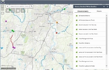
The purpose of this interactive map is to provide the angling community with near real-time information on stocked waters (the number of days since the most recent stocking event) and improved location information about Connecticut’s trout stocked waters.
Anglers will have several options including where to find the waters that were stocked within the past day, week or month. There are several categorical searches including, all rivers/streams or lakes/ponds, trout management areas, community fishing waters, and trout parks.
Connecticut DEEP Interactive Trout Stocking Map
Topographic Trout Stocking Maps
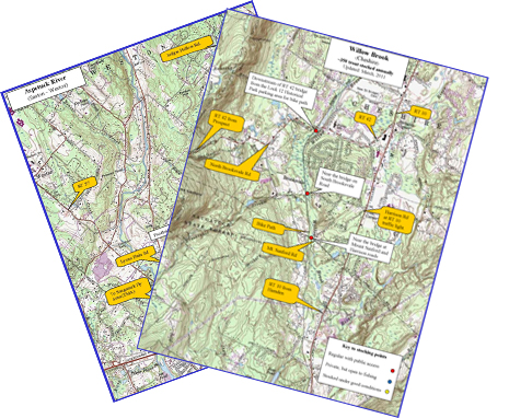
Standard topographic maps showing many of the river and stream locations where trout are stocked are available to download or print.
Please select a stocking map.
A pdf of waterbodies and stocking dates is available through our online Trout Stocking Report.
For a complete list of locations and numbers of all fish species stocked last year, please see the Annual Fish Stocking Report.
![]()
![]()

Please contact the Fisheries Division with any questions.
Phone: 860-424-FISH (3474)
E-mail: deep.inland.fisheries@ct.gov
Content last updated in May 2024.