

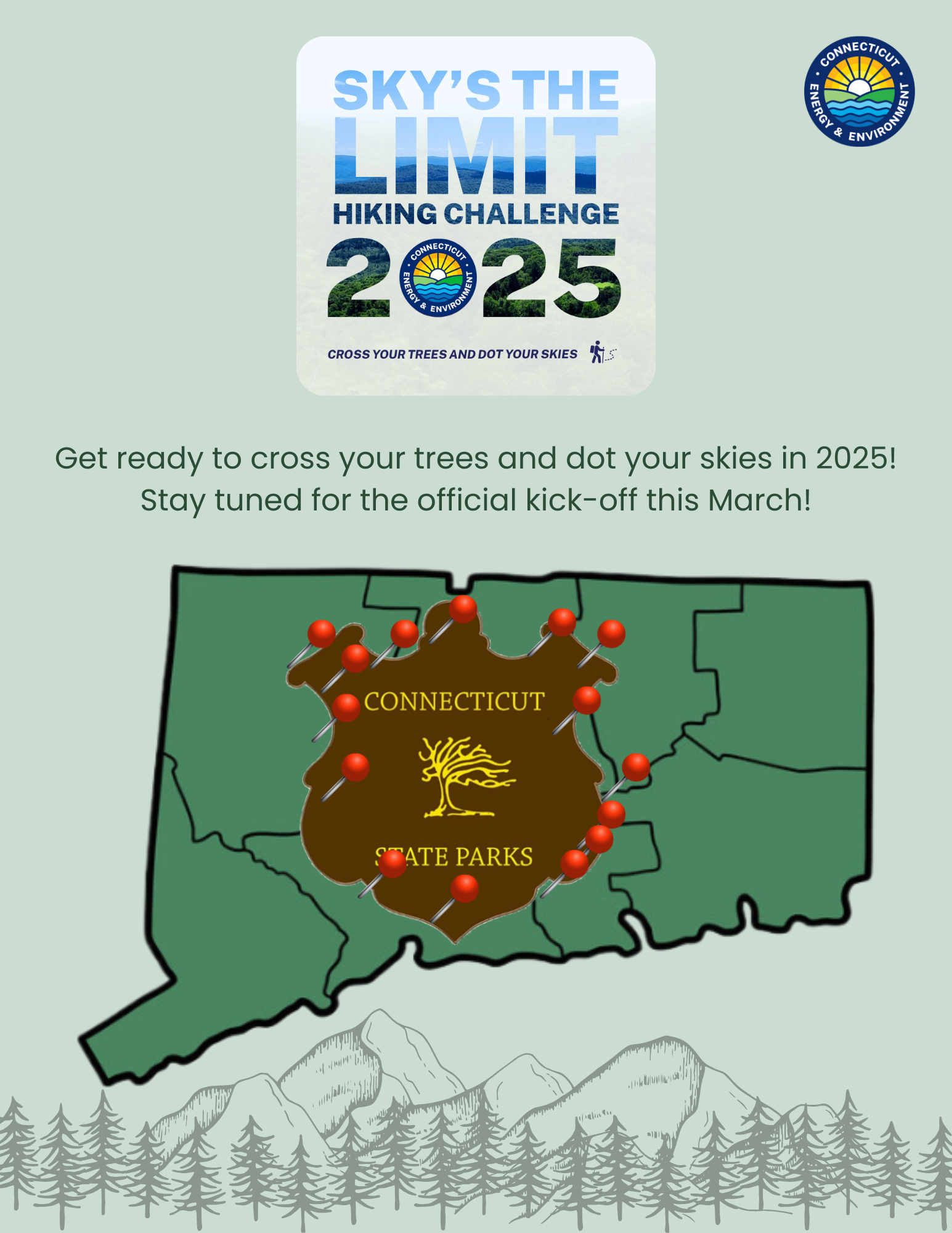
2025 Sky’s The Limit Hiking Challenge
Cross Your Trees and Dot Your Skies
Ready for an outdoor hiking adventure? Go on your own, grab a friend or family member, or bring your leashed four-legged companion along for this year's Sky’s The Limit Hiking Challenge (STL). If so, join the Connecticut Department of Energy and Environmental Protection’s (CT DEEP) State Parks and Public Outreach Division as they celebrate the first week of spring with the annual release of the new Sky's the Limit theme.
Take the Sky's the Limit challenge to get outside for some fresh air and physical exercise. Hike and walk the highlighted locations/trails and take designated photos along the way. Fifteen (15) State Park and Forest locations will be identified for participants to explore, with varying scenery and highlights at each location.
This year, the “Cross Your Trees and Dot Your Skies” theme is a poetic way of embracing the beauty in Connecticut State Parks and Forests - observing the way nature connects everything. Each step on the trail is like connecting the dots, noting how all the small details make up the bigger picture. Whether it’s the first buds on a tree, the songs of birds returning, or the warmth of the sun on one's skin, spring invites us to be present and appreciate the surrounding renewal. By visiting the 15 locations in this year’s challenge and “connecting the dots” on a map, participants will ultimately be forming the shape of the Connecticut State Parks shield sign.
Annually on New Year's Day, January 1 (or another date if determined), names will be randomly drawn from those who visited all fifteen (15) locations, and 50 participants will receive a hand-carved hiking staff made by our DEEP Sawyer who works at our CT DEEP Sawmill or by the CT Woodcarvers Association.
All entries are due by 3 pm on Friday, December 6, 2025.
Post photos on social media using #CTSTL2025 or #CTStateParks.
Scroll down the page for further details.

Hike or walk the listed trails within the 15 Connecticut State Parks or Forests.
Please be aware that the number of miles included in the write-ups below are suggested for participants to hike or walk. Please Note: Participants can shorten or lengthen their hike or walk they take at their discretion.
Overview map of STL locations, courtesy of CT Trail Finder.
Overview map created by DEEP State Parks staff.
Snap a photo.
Snap a photo of yourself (and your leashed dog if he/she joins you) by a designated State Park or Forest sign (this could be a shield sign, other signage or a kiosk with the name of the state forest, or a trail sign identifying the location). Specific details may be found in each location's description.
Take additional photos of yourself.
Take additional photos of yourself (and your dog if he/she joins you) at the location(s) described in the specific write-up(s) below. Please note: Some locations may require several photos be taken.
Submit your entry.
Sky's the Limit (STL) entries are submitted using a Google form. To use this form, a person may be required to sign-in to Google or set-up a Google account. By using the Google form, no other document or email needs to be submitted. Return to this page in April 2025 for the most updated submittal form.
Entries must be received by 3 pm on Friday, December 5, 2025.
Please note: If participants are unable to use the Google form or have specific questions, please contact DEEP.SkystheLimit@ct.gov for assistance. When providing attachments (photo or document) please do not send links to external sources (Facebook, etc.). We often have a difficult time accessing external sources. Please be sure to include the following information: name, address, email, phone number, and signed photo release Photo Release Form (each STL hiking participant shall submit a signed Photo Release). This form can be printed out, filled out and then a photo of the form can be taken and sent in with your submission.
Know the additional information.
Reminder: to be entered to win a hiking staff (live drawing on January 1 annually, or another date, if determined) all entries with the completion of all 15 hiking/walking locations, must be received by 3 pm on Friday, December 5, 2025, to be entered into the drawing.
NEW! CT Trail Finder:
For this year’s Sky’s the Limit (“STL) Hiking Challenge, DEEP State Parks has had the honor of partnering and working with UCONN Extension and CT Trail Finder to provide a new user experience for STL participants. CT Trail Finder has created Sky’s the Limit Trail Finder posts for each of the 15 Hiking locations chosen for this year’s STL challenge. These links/posts provide the STL participant with detailed descriptions, information, maps, trail information, and contact information for each of the 15 CT State Park or Forest locations chosen. Participants are encouraged to use the STL Trail Finder posts, especially the following tabs: Details, Directions, Trail Maps, Trail Alerts in completing the challenge for 2025.
Helpful information regarding the CT Trail Finder experience is located on the following pages:
- View the CT Trail Finder Welcome
- CT Trail Finder Tips & Tricks
- View the Trails
- To learn more about CT Trail Finder, check their Frequently Asked Questions
- Creating an Account: STL participants are able to (but not required to) create a free user account through the CT Trail Finder site. With a free user account, participants can keep track of trails hiked and walked, sites already visited, and favorites. Participants can even save trail logs to keep a record of adventures, and can share adventures with others by commenting on a trails page or uploading a photo.
CT Trail Finder links include geocaches near many of the trails. Please visit the live link on the bottom right corner of each CT Trail Finder page for geocache details.
CT Trail Finder is administered by the UConn CT Trails Program which is part of the UConn College of Agriculture Health and Natural Resources. CT Trail Finder is funded by the generous support of the CT Department of Energy and Environmental Protection and the CT Greenways Council. Visit Partners & Funders to learn more about the partners who support and contribute to this project.
Canine STL Participants:
As many of our STL participants hike with their canine friends, we will have a special giveaway for the dogs again this year.
Please be aware of the following if hiking with a canine friend:
- State regulations require dogs to be on a leash no longer than 7 feet
- Dogs are permitted in most state parks and forests, but are not allowed in buildings, swimming areas, or state park campgrounds
- Dogs must be under the control of the owner or keeper at all times
- Owners/handlers must remove and properly dispose of pet waste
- Check individual park/forest pages for more specific information on specific pet policies at each location
Before heading out onto the trails with your dog, be sure to review additional information on each individual forest webpage on the DEEP website or CT Parks website and also visit the Responsible Recreation section of the DEEP website.

Hop River State Park-Vernon, CT
STL Trail Finder Post: Hope River State Park Trail
Trail: Hop River State Park Trail
Parking: park in the Church Street parking lot and hiking/walking towards Bolton Notch State Park
Distance: approximately 3 miles out and back. Please hike or walk the trail to a distance you and those in your group are comfortable with.
Maps: Hop River State Park Trail Map, CT Trail Finder Map, Connecticut Rail Trail Explorer, Trail Overview Map
Photo Locations: 1) park shield sign or kiosk sign; 2) photo of a remnant portion of the former railroad line; and 3) photo of your choosing along the trail
Other Information: Please visit the state parks pages by clicking the link above and scroll to the bottom of the page where it says “While You Are Here” to find other things to do while visiting this location.
Shenipsit State Forest-Somers/Stafford, CT
STL Trail Finder Post: link to be added -Connecticut Trail Finder
Trail: hike or walk Connecticut Horse Council Soapstone Loop A marked by yellow plastic diamond trail tags (trail is colored orange on the map). Parking locations on the trail map are approximate. Start and finish the loop from the parking area of your choice
Parking: Sodom Road within Shenipsit State Forest-Accessed off of State Hwy 190 (Look for the Shield Sign)
Distance: approximately 3.25 mile loop. Please hike or walk the trail to the distance you and those in your group are comfortable with
Maps: Shenipsit State Forest Map, STL 2025 Shenipsit State Forest Map, CT Trail Finder Map-link to be added, State Forest Overview Map
Photo Locations: 1) park shield sign or kiosk sign; 2) photo of the tallest or shortest tree you find in Shenipsit State Forest along the trail; and 3) photo of your choosing along the trail
Other information: Please visit the state parks pages by clicking the link above and scroll to the bottom of the page where it says “While You Are Here” to find other things to do while visiting this location.
While you’re in the area come visit Connecticut’s Historic Museum of the Civilian Conservation Corps (CCC). The address for the CCC Museum is 166 Chestnut Hill Road in Stafford Springs, CT. Hours of the CCC Museum are as follows: 10 am to 3 pm on weekends and Holidays, Memorial Day through Columbus Day.
While visiting this trail, you may encounter horses. If you are unsure of how to approach a horse on a trail, please review these guidelines.
Letterboxing is also an option while visiting Shenipsit State Forest.
During the appropriate seasons, please note that hunting is allowed in Shenipsit State Forest. Consider wearing bright clothing and avoid wearing gray, brown, tan, or white when hiking in hunted areas to increase your visibility.
Air Line State Park-Colchester, CT
STL Trail Finder Post: Air Line State Park Trail - Connecticut Trail Finder
Trail: portion of Airline Trail between Bull Hill Road and head northwest toward River Road
Parking: park in Colchester off of Bull Hill Road, .3 miles north of River Road intersection or River Road, near the intersection with South Street
Distance: approximately 4 miles out and back between Bull Hill Road and River Road. Please hike or walk the trail to the distance you and those in your group are comfortable with.
Maps: Colchester Map portion of trail, CT Trail Finder Map, CT Rail Trail Explorer, Air Line Trail Guide & Map
Photo Locations: 1) park shield sign or kiosk sign; 2) photo of one of the following: Lyman Viaduct or the River Road Bridge; and 3) photo of your choosing along the trail
Other information: Please visit the state parks pages by clicking the link above and scroll to the bottom of the page where it says “While You Are Here” to find other things to do while visiting this location.
Day Pond State Park-Colchester, CT
STL Trail Finder Post: Salmon River State Forest and Day Pond State Park - Connecticut Trail Finder
Trail: North Loop of the Salmon River Trail out and back; and/or North Loop to the gravel round, head south to the South Loop of the Salmon River Trail and head back to the parking lot
Parking: Park in the parking lot near the North Loop Trail (Salmon River Trail) as shown on Map
Distance: Approximately 2.8 miles following the North Loop out and back; and/or approximately 3 miles on the North/South Loops of the Salmon River Trail to make a full loop.
Please hike or walk the trail to the distance you and those in your group are comfortable with.
Maps: Day Pond State Park Map, CT Trail Finder Map
Photo Locations: 1) park shield sign or kiosk sign; 2) photo of Day Pond; and 3) photo of your choosing along the North Loop or South Loop of the Salmon River Trail within Salmon River State Forest
Other information: Please visit the state parks pages by clicking the link above and scroll to the bottom of the page where it says “While You Are Here” to find other things to do while visiting this location.
Sunrise & Machimoodus State Park-East Haddam, CT
STL Trail Finder Post: Machimoodus State Park - Connecticut Trail Finder
Trail: Upper Vista Trail and Lower Vista Trial, from the parking lot, follow the gravel road to Lower Vista Trail (Purple Trail), turn right at Blue Trail, stay left to Yellow Trail, stay straight through unblazed section and gravel road, turn right on Lower Vista Trail (Purple Trail), turn left to Purple Trail, turn left to Upper Vista Trail, turn right to Gravel Road back to parking lot by making a loop
Parking: park in the parking lot near the entrance to the Park as shown on the map
Distance: following the trail(s) above, the approximate distance will be 2.5 miles. Please hike or walk the trail to the distance you and those in your group are comfortable with.
Maps: Sunrise Machimoodus Map, CT Trail Finder Map
Photo Locations: 1) park shield sign or kiosk sign; 2) photo of your choosing from the blue trail or yellow trail and 3) photo of your choosing along the Upper Vista Trail or Lower Vista Trail
Other information: Please visit the state parks pages by clicking the link above and scroll to the bottom of the page where it says “While You Are Here” to find other things to do while visiting this location.
Cockaponset State Forest (Southern Section)-Chester & Haddam, CT
STL Trail Finder Post: Cockaponset State Forest (South) - Connecticut Trail Finder
Trail: follow the Blue Trail (Cockaponset Trail) south, turn right to Blue/Red Trail, follow back north to Blue Trail, turn right back to parking lot to make a loop
Parking: park in one of the parking lots along the southern end of the Pattaconk Reservoir as shown on the map
Distance: following the trails above, the approximate distance will be 3.12 miles. Please hike or walk the trail to the distance you and those in your group are comfortable with.
Maps: Cockaponset State Forest Map, CT Trail Finder Map
Photo Locations: 1) park shield sign or kiosk sign; 2) photo of your choosing from the Blue Trail (Cockaponset Trail); and 3) photo of your choosing from along the Blue/Red Trail
Other information: Please visit the state parks pages by clicking the link above and scroll to the bottom of the page where it says “While You Are Here” to find other things to do while visiting this location.
Pattaconk Reservior Recreational area provides access to an unprotected swimming and paddling area and the trailhead is the main recreational area within the forest.
There are four youth group camping lean-tos available through coordination with the Connecticut Department of Energy and Environmental Protection (CT DEEP).
The state forest also allows hunting and fishing access. Consider wearing bright clothing and avoid wearing gray, brown, tan, or white when hiking in hunted areas to increase your visibility.
Wharton Brook State Park-Wallingford, CT
STL Trail Finder Post: Wharton Brook State Park - Connecticut Trail Finder
Trail: hike/walk the paved and unpaved road to the main foot trail and its short extension trails (marked in grey) through the Wharton Brook State Park into the Wharton Brook Natural Area Preserve. The hiking and walking trail provides a perimeter loop around the northern section of park through the Wharton Brook Natural Area Preserve as well as walking adjacent to the Pond.
After walking the foot trail, walk the perimeter of Allen Brook Pond.
Parking: park in the main parking lot closest to the Allen Brook Pond
Distance: following the paved and unpaved road, the main foot trail and its short extensions as well as walking the perimeter of the pond, the approximate distance will be approximately 1.4 miles. Please hike or walk the trail to the distance you and those in your group are comfortable with.
Maps: Wharton Brook State Park Map, CT Trail Finder Map
Photo Locations: 1) park shield sign or kiosk sign; 2) photo of your choosing from within the Wharton Brook Natural Area Preserve; and 3) photo of your choosing during your walk around Allen Brook Pond
Other information: Please visit the state parks pages by clicking the link above and scroll to the bottom of the page where it says “While You Are Here” to find other things to do while visiting this location.
Naugatuck State Forest (East Block)-Bethany & Naugatuck, CT
STL Trail Finder Post: Naugatuck State Forest East Block - Connecticut Trail Finder
Trail: Blue Blazed Trail out and back and/or Blue/White Trail to Blue Trail out and back. The primary hiking trail in this block is the blue-blazed Naugatuck Trail, managed by Connecticut Forest & Park Association.
Parking: Park near Andrasko Road and take the Blue Trail out and back; and/or
park off Beacon Rd and take Whittemore Trail (Blue/White) to Blue Trail out and back
Distance: Up to 11 miles round trip if following Blue Trail end to end and back, actual distances will vary. Please hike or walk the trail to the distance you and those in your group are comfortable with.
Maps: Naugatuck State Forest East and West Blocks Map, CT Trail Finder Map
Photo Locations: 1) park shield sign or kiosk sign; 2) photo of your choosing from the Blue Trail (Naugatuck Trail) at “scenic view” area as labeled on the Parks Map and 3) photo of your choosing from the Blue/White Trail (Whittemore Trail)
Other information: Please visit the state parks pages by clicking the link above and scroll to the bottom of the page where it says “While You Are Here” to find other things to do while visiting this location.
The state forest also allows hunting. Consider wearing bright clothing and avoid wearing gray, brown, tan, or white when hiking in hunted areas to increase your visibility.
Letterboxing is also an option while visiting this area.
Larkin State Park Trail-Oxford, CT
STL Trail Finder Post: Larkin State Park Trail - Connecticut Trail Finder
Trail: follow Larkin Trail west and return (out and back)
Parking: park near 816 Church Street (CT-63), Naugatuck, CT
Distance: approximately 5.8 miles if turning at Rubber Ave parking area. Please hike or walk the trails to the distance you and those in your group are comfortable with. Please be aware that areas along this trail may be extremely wet.
Maps: Larkin Trail Map, CT Trail Finder Map, CT Rail Trail
Photo Locations: 1) park shield sign or kiosk sign; 2) photo of a “feature” along the trail; 3) photo of your choosing anywhere along this scenic trail
Other information: Please visit the state parks pages by clicking the link above and scroll to the bottom of the page where it says “While You Are Here” to find other things to do while visiting this location.
Please note: Due to extreme flooding conditions in 2024, portions of the Larkin State Park Trail are closed. Specifically, a large section of the trail from Kettletown Road in Southbury to Christian Street in Oxford remains closed due to damage sustained during the flooding event. Please see attached information and map. Please be aware that after rain events, areas of this trail may be extremely wet.
Black Rock State Park-Watertown, CT
STL Trail Finder Post: Black Rock State Park - Connecticut Trail Finder
Trail: Blue Trail leading up to the Leatherman’s Cave and back
Parking: park at Black Rock Road Trailhead off of Conn 6 & 202
Distance: approximately 5.5 miles up and back. Please hike or walk the trail to the distance you and those in your group are comfortable with.
Maps: Black Rock State Park Map, CT Trail Finder Map
Photo Locations: 1) park shield sign or kiosk sign; 2) a photo of your choosing along the trail to the Leatherman’s Cave (“rock house”); and 3) before or after the hike, visit Black Rock State Park and take a photo in the over-sized adirondack chair located outside the Camp Office.
Other information: Please visit the state parks pages by clicking the link above and scroll to the bottom of the page where it says “While You Are Here” to find other things to do while visiting this location.
Topsmead State Forest-Litchfield, CT
STL Trail Finder Post: Topsmead State Forest - Connecticut Trail Finder
Trails: five (5) accessible trails on the property as shown on the Topsmead State Forest Map/Friends of Topsmead State Forest Map including the following: 1) Edith Chase Ecology Trail; 2) Bernard Stairs Trail; 3) Red Trail; 4) Yellow Trail; and 5) Songbird Trail
Parking: park in the main parking lot on-site off of Chase Road as shown on map
Distance: approximately 4.2 miles of trails. Please hike or walk the trails to the distance you and those in your group are comfortable with.
Maps: Topsmead State Forest Map, Friends of Topsmead State Forest Map, Edith Morton Chase Ecology Map, CT Trail Finder Map
Photo Locations: 1) park shield sign or kiosk sign; 2) photo of the flowers, bird(s), or butterflies in and around the wildlife viewing stand 3) photo of your choosing from within Topsmead State Forest.
Other information: Please note that there are 2 all-terrain wheelchairs at this location available to users with mobility impairments. These wheelchair are free of charge. Visitors will be able make reservations to use the all-terrain wheelchairs after completing a short video training. Please visit the all-terrain wheelchair website for details and information.
Be sure to take a tour of the Chase Cottage when it is open-typically Memorial Day through Labor Day. The Friends of Topsmead State Forest offers free 30-minute tours from June through October on the 2nd and 4th weekends of each month.
Please visit the state parks pages by clicking the link above and scroll to the bottom of the page where it says “While You Are Here” to find other things to do while visiting this location.
Burr Pond State Park-Torrington, CT
STL Trail Finder Post: Burr Pond State Park - Connecticut Trail Finder
Trail: from the main parking area, join the Blue Trail in either direction and follow around the pond and/or follow the John Muir and Blue/White Trails to extend the loop and/or add the Peninsula Trail -Jenkins Trail
Additional Trail information
Parking: park in the main parking lot on-site and as shown on the map
Distance: approximately 2.6 miles or up to 3.5 miles with extensions. Please hike or walk the trail to the distance you and those in your group are comfortable with.
Maps: Burr Pond State Park Map, CT Trail Finder Map
Photo Locations: 1) park shield sign or kiosk sign; 2) photo of your choosing from the trail around Burr Pond State and 3) before or after the hike, drive down to the beach at Burr Pond State Park and take a photo in the over-sized adirondack chair on the beach-located to the right.
Other information: Please visit the state parks pages by clicking the link above and scroll to the bottom of the page where it says “While You Are Here” to find other things to do while visiting this location.
This park also offers canoe and kayak rentals between Memorial Day and Labor Day.
Dennis Hill State Park-Norfolk, CT
STL Trail Finder Post: Dennis Hill State Park - Connecticut Trail Finder
Trail: from the parking area, follow the Yellow Trail-Gazebo Loop Trail with optional White Trail extension out and back and/or hike walk out to the pavilion
Parking: park in the main parking lot once you enter the park as shown on the map
Distance: approximately 1.45 miles out and back on the Yellow Trail-Gazebo Loop Trail; approximately 1.9 miles out and back on the Yellow Trail-Gazebo Loop Trail and the White Trail; and approximately 1.24 miles out to the pavilion and back. Please hike or walk the trail to the distance you and those in your group are comfortable with.
Maps: Dennis Hill State Park Map, CT Trail Finder Map
Photo Locations: 1) park shield sign or kiosk sign; 2) photo from the Gazebo Loop Trail “scenic view”; and 3) photo of your choosing from along the trails at Dennis Hill State Park.
Other information: Please visit the state parks pages by clicking the link above and scroll to the bottom of the page where it says “While You Are Here” to find other things to do while visiting this location.
Hike to the 1,627 foot summit of the Dennis Hill Estate for panoramic view stretching across Litchfield County.
Peoples State Forest-Barkhamsted, CT
STL Trail Finder Post: American Legion and Peoples State Forests - Connecticut Trail Finder
Trail: start the hike on the Robert Ross Trail (Blue Trail) by the Nature Center, follow north until the intersection of the Agnes Bowen Trail (Blue/Orange Trail), turn right (northeast) and follow the Blue/Orange Trail down (south) until you loop back to the Nature Center and back to the parking lot
Parking: park in the parking lot off of East River Road or the parking lot off of Greenwoods Rd as shown on the map
Distance: approximate 3.1 mile loop. Please hike or walk the trail to the distance you and those in your group are comfortable with.
Maps: American Legion and Peoples State Forest Map, CT Trail Finder Map, FALPS Hiking Trail Map
Photo Locations: 1) park shield sign or kiosk sign; 2) photo of your choosing from the Robert Ross Trail and 3) a photo of your choosing from the Agnes Bowen Trail
Other information: Please visit the state parks pages by clicking the link above and scroll to the bottom of the page where it says “While You Are Here” to find other things to do while visiting this location.
Scantic River State Park-East Windsor, CT
STL Trail Finder Post: Scantic River State Park - Connecticut Trail Finder
Trail: Follow River Loop Yellow Trail starting at Melrose Road heading south to North Road (out and back)
Parking: Park off Melrose Rd
Distance: approximately 3.2 miles out and back. Please hike or walk the trail to the distance you and those in your group are comfortable with.
Maps: Scantic River State Park Map, CT Trail Finder Map to be added, Scantic River Map
Photo Locations: 1) park shield sign or kiosk sign; 2) photo taken from one of benches along the River Loop Trail; and 3) photo of your choosing looking out into the Scantic River from the River Loop Trail
Other information: Please visit the state parks pages by clicking the link above and scroll to the bottom of the page where it says “While You Are Here” to find other things to do while visiting this location.
Beginning in Mid-October sections of the park is open to hunters. Consider wearing bright clothing and avoid wearing gray, brown, tan, or white when hiking in hunted areas to increase your visibility.

Helpful Information and Guidelines
For the safety of fellow Sky's the Limit hikers, DEEP staff, and others enjoying the trails, please remember the following when walking and hiking with the STL Hiking Challenge:
- If you’re not feeling well, stay home!
- If you arrive at a forest or park and crowds are forming, choose a different trail, or return another day or time.
- Warn other trail users of your presence and as you pass to allow proper distance and step off trails to allow others to pass. Signal your presence with your voice, bell, or horn.
- While enjoying your hike or walk, be safe outdoors by staying on the marked trails, and most importantly, have fun exploring.
- Bring water or drinks.
- Bring a whistle, sunblock, map and insect repellant.
- Dress for the weather. It is best to dress in layers. As you warm up while hiking, you can remove outer layers.
- Wear proper footwear based on weather and site conditions.
- Be aware that state park and forest trails can flood during and after rain events.
- Hunting is allowed in most state forests and some state parks so check out the CT Hunting and Trapping Guide and don't forget to wear orange during hunting season. Also, bring a whistle or make noise so hunters know you are in the area.
- Be Bear Aware and do make your presence known by making noise while hiking. If you see a bear, make enough noise and wave your arms so the bear is aware of your presence.
- Remember to protect yourself from Lyme disease and other tick-borne diseases.
- Dogs must be on a leash (max 7 feet long) for their safety, the safety of wildlife and fellow hikers. Please visit the Responsible Recreation site for more information.
- Don't forget to bring a map and know what the trail blazes mean (don't think just because there is a wide-open trail that is the correct way to go, there might be a spur trail that is not obvious).

- Be aware of your surroundings and alternate trail options. There might be a trail that takes you around a steep area, consult your map.
- Remember to check the State Parks Twitter to confirm the park is open and plan your trip accordingly. With the Passport to Parks Program, Connecticut residents are no longer required to pay a parking fee at CT State Parks and Forest recreation areas, due to DMV collecting a $24 fee ($8 per year) on behalf of DEEP at the time of registration and registration renewals for non-commercial motor vehicles.
- Stay clear of active forest management. Roads and trails may be temporarily closed to accommodate tree thinning activities.
- Check out the Trail Safety and Etiquette Guidelines for Trail Users provided by UCONN and CT Trails
- On the trail, courtesy is a necessity: if you ride a bike, you must yield to all other trail users; if you are hiking or walking around, you must yield to horses and equestrians; if you ride a horse, you have priority but should observe caution because not all trail users will be aware of this. If you are unsure of how to approach a horse on a trail, these guidelines can help.
Please be aware that the number of miles included in the write-ups above are suggested for participants to hike or walk. Participants can shorten or lengthen the hike or walk they take at their discretion.
Sky’s the Limit Participant Photos and Hiking Stick Winners


